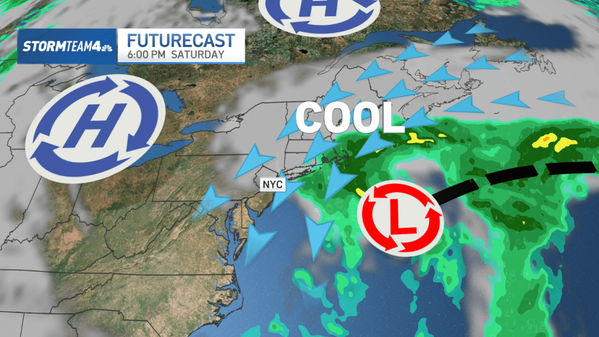
A coastal low will meander offshore just east of the tri-state and New England this weekend, bringing gusty wind, rough surf and rain.
A strong northeast breeze has already developed in the region, bringing high surf to the Long Island and New Jersey coasts that will last through the weekend.
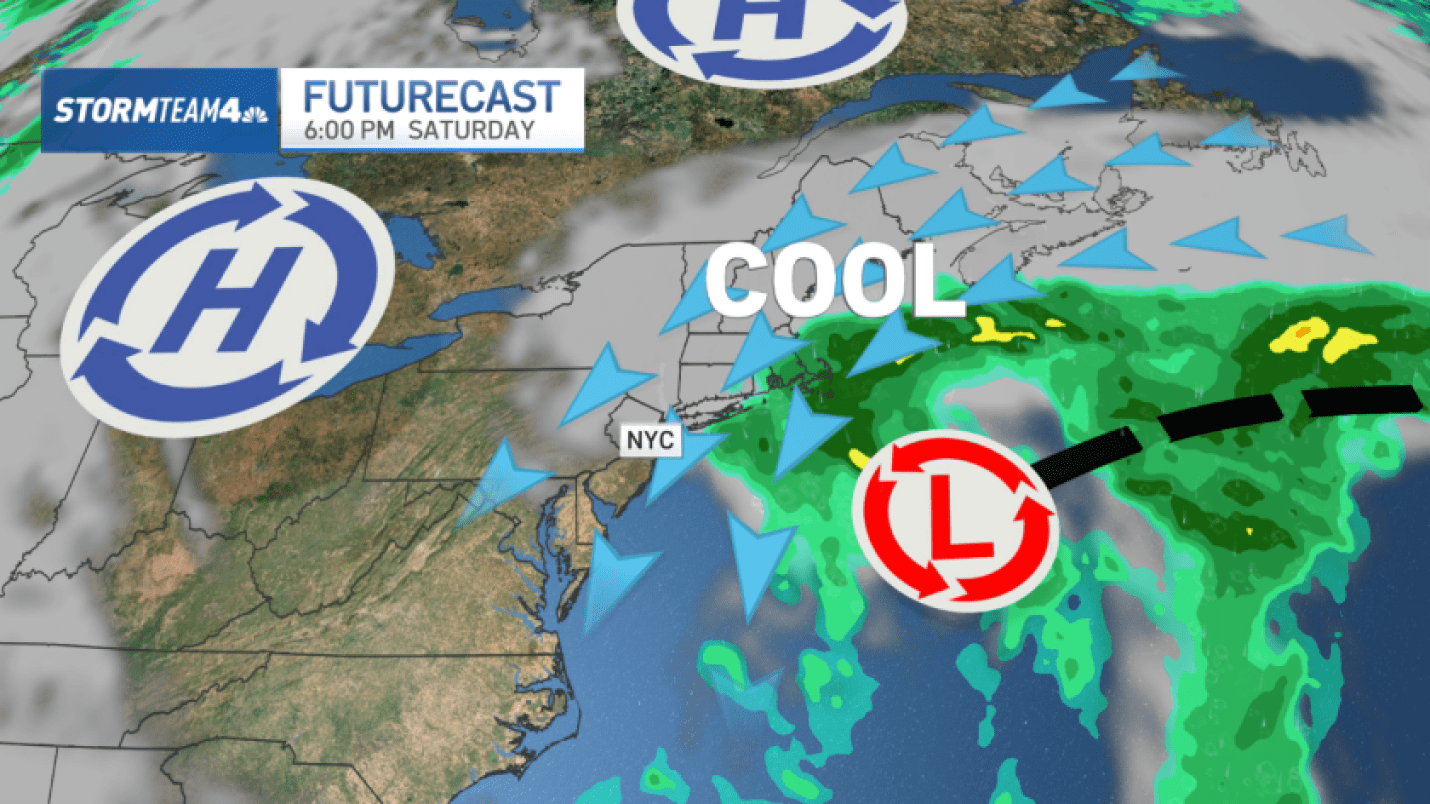
The breezy conditions are the result of a high pressure ridge anchored to the north and an area of low pressure to the south. An easterly wind is funneling between the two, causing a wind tunnel effect that will strengthen as the low pressure system deepens by the weekend.
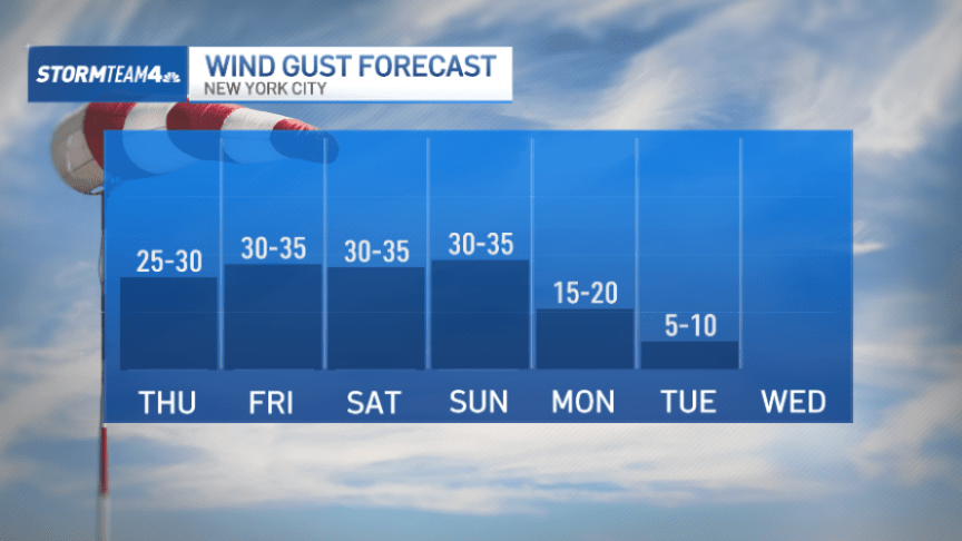
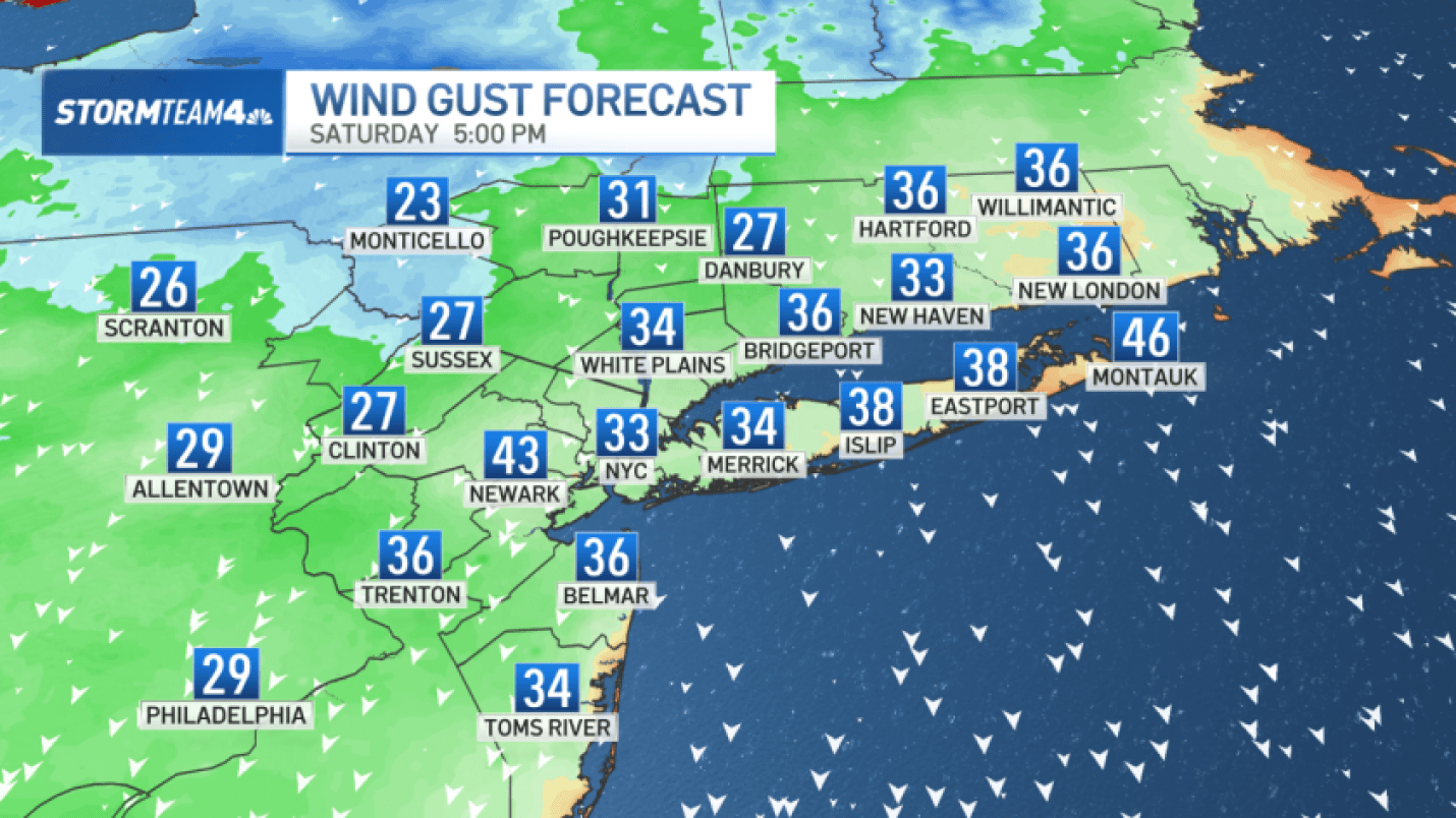
In and around New York City, wind gusts will hold between 20-30 mph through Thursday, then jump to 30+ mph from Friday through Sunday. Gusts on Long Island will be higher – between 40 and 50 mph – this weekend because of its closer proximity to the center of low pressure.
The track of the low is becoming more certain as the European and American long-range forecast models begin to converge on a similar solution.
What we know
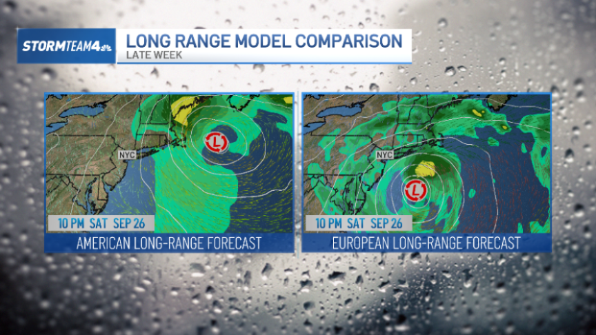
The low pressure system will begin to strengthen, or deepen, on Friday. As it does, winds will become stronger.
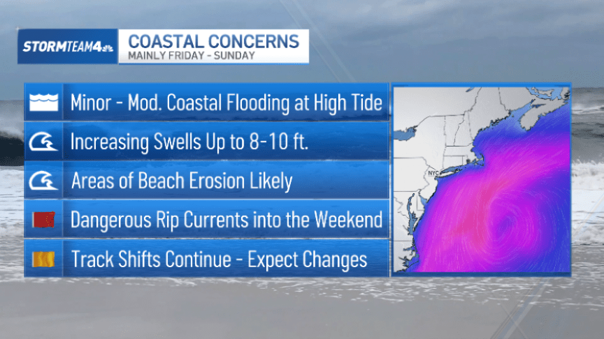
On Long Island, expect wind gusts to be between 40-50 mph Saturday and Sunday. The Jersey Shore will probably experience gusts slightly below that, but the seas will be churning all along the East Coast, making coastal erosion and high tide flooding a concern.
The full moon on Saturday will enhance high tides and make coastal flooding worse, and the extended duration of the gusty conditions will exacerbate the coastal flooding that results from this system.
The region will stay gray and chilly, with afternoon temperatures holding in the 60s. Expect at least some rain this weekend, with the highest amounts on Long Island and through southeastern New England.
What remains uncertain
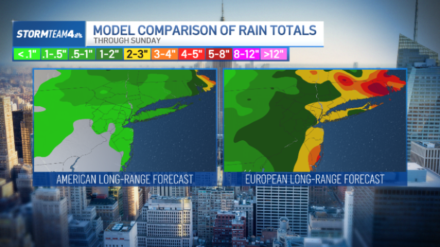
The biggest wild card with this weekend’s storm will be rainfall.
We expect rain to begin moving onshore in the tri-state as early as Friday afternoon and last, on and off, through the weekend.
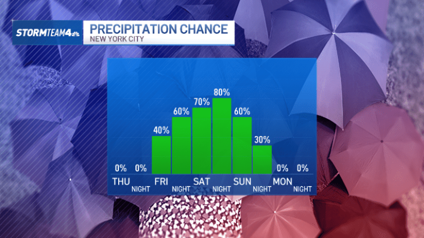
For many, the weekend will be largely dry and rain totals will be minimal. For others, especially those on Long Island, up to 2 inches is certainly possible.
Current long-range forecasts are still inconsistent when it comes to rain amounts from the storm.
As far as nor’easters go, this one will be low to moderate impact. It is happening early in the fall, so there’s no snow involved.
Nor’easters are typically associated with strong coastal lows during the winter months that deliver howling winds, blowing snow and whiteout conditions that grind the coast to a halt; This weekend’s storm is not that.
We also don’t expect it to be an extremely intense low pressure system at its height Saturday into Sunday. Winds will be dampened somewhat because of that.
The low will begin to weaken late Sunday into Monday and eventually exit the region entirely, leaving quite nice weather for us next week. Expect highs in the 70s with plenty of sunshine.