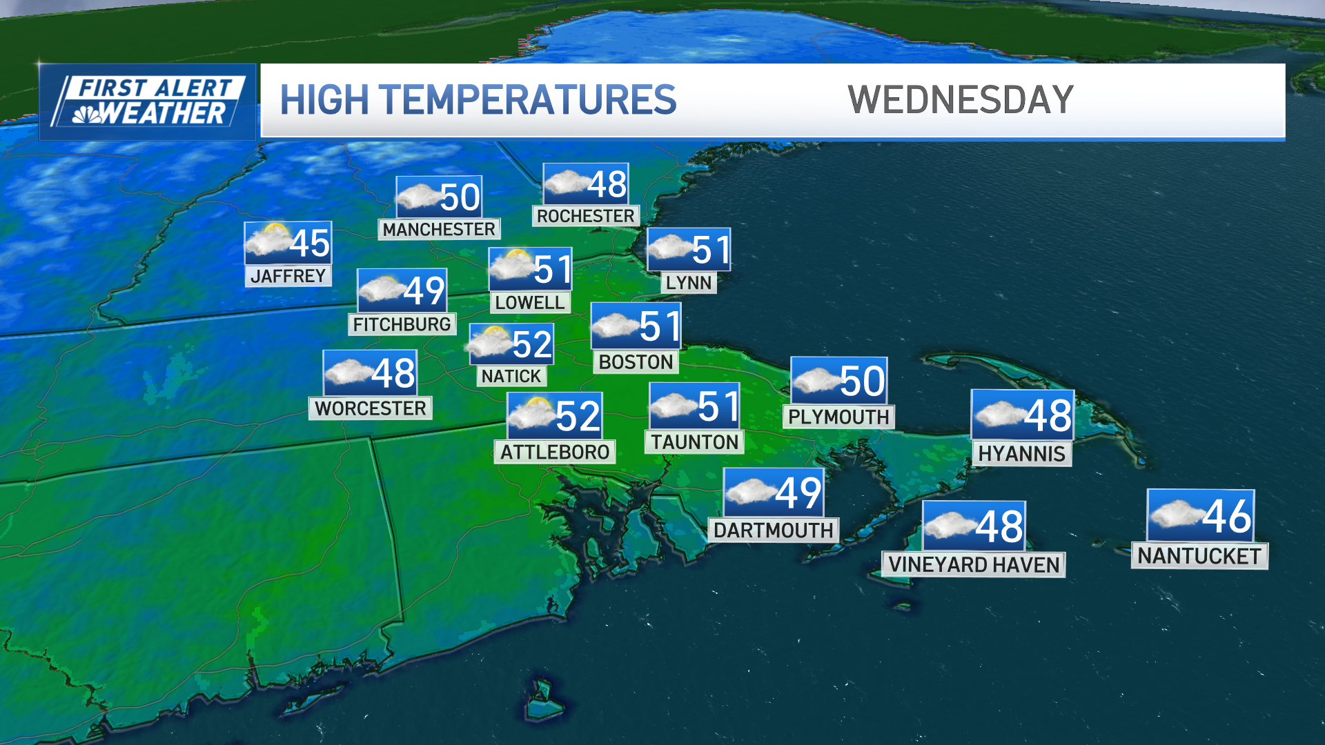
We’re basking in more mild air today. Highs should close in on 50 degrees in many towns and cities this afternoon.
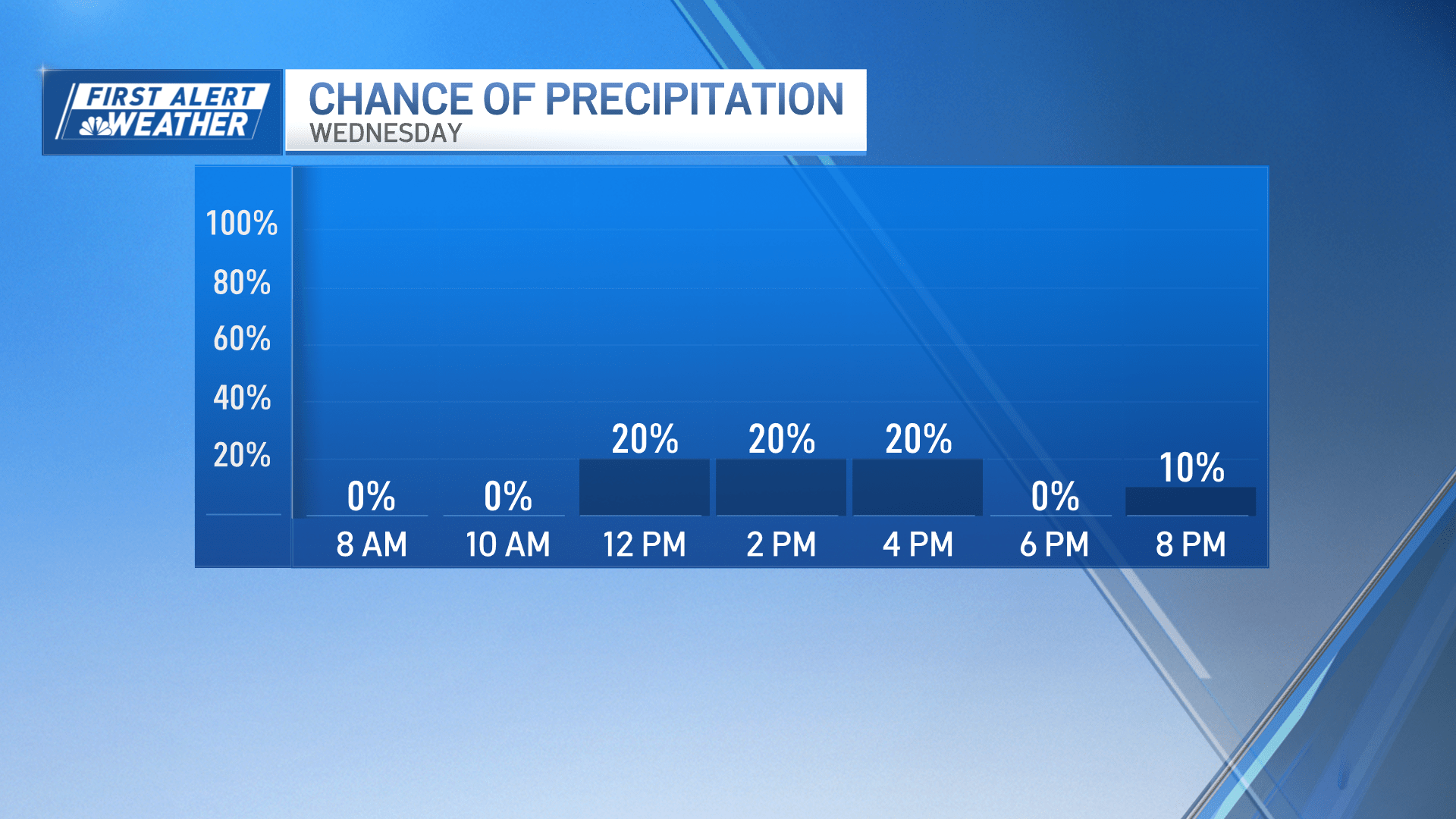
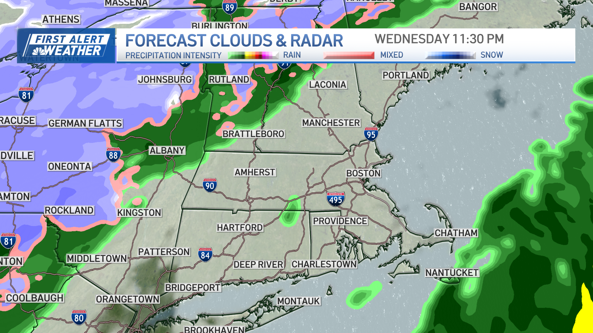
Brisk southwest winds will back down through this morning, too. With all the clouds around, there may be a few widely scattered showers, but many of us will stay dry.
Live radar
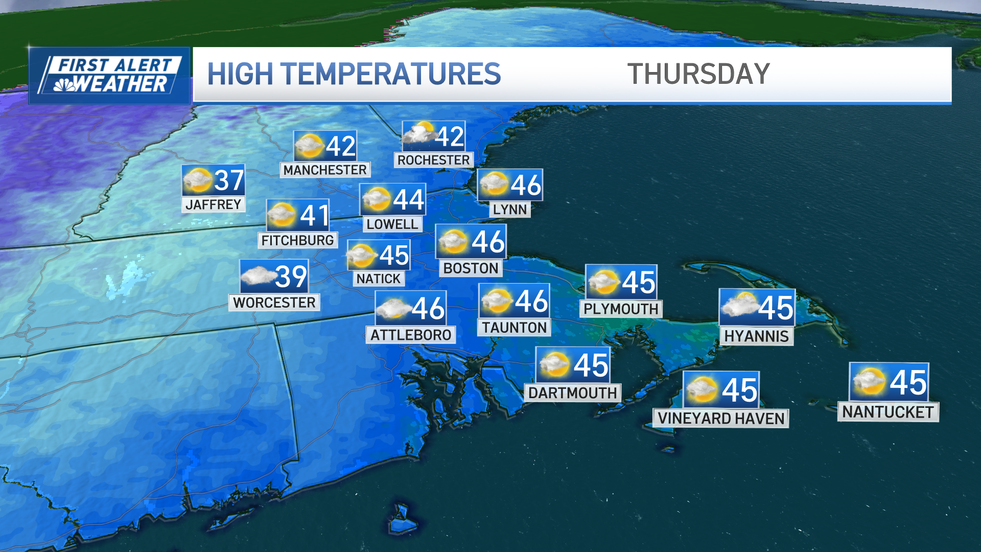
A sharp cold front will slice through early on Thursday. While we still manage to make the mid-40s, we won’t stay there for long. Temperatures tumble back to the 30s in the afternoon, with 20s expected later in the evening.
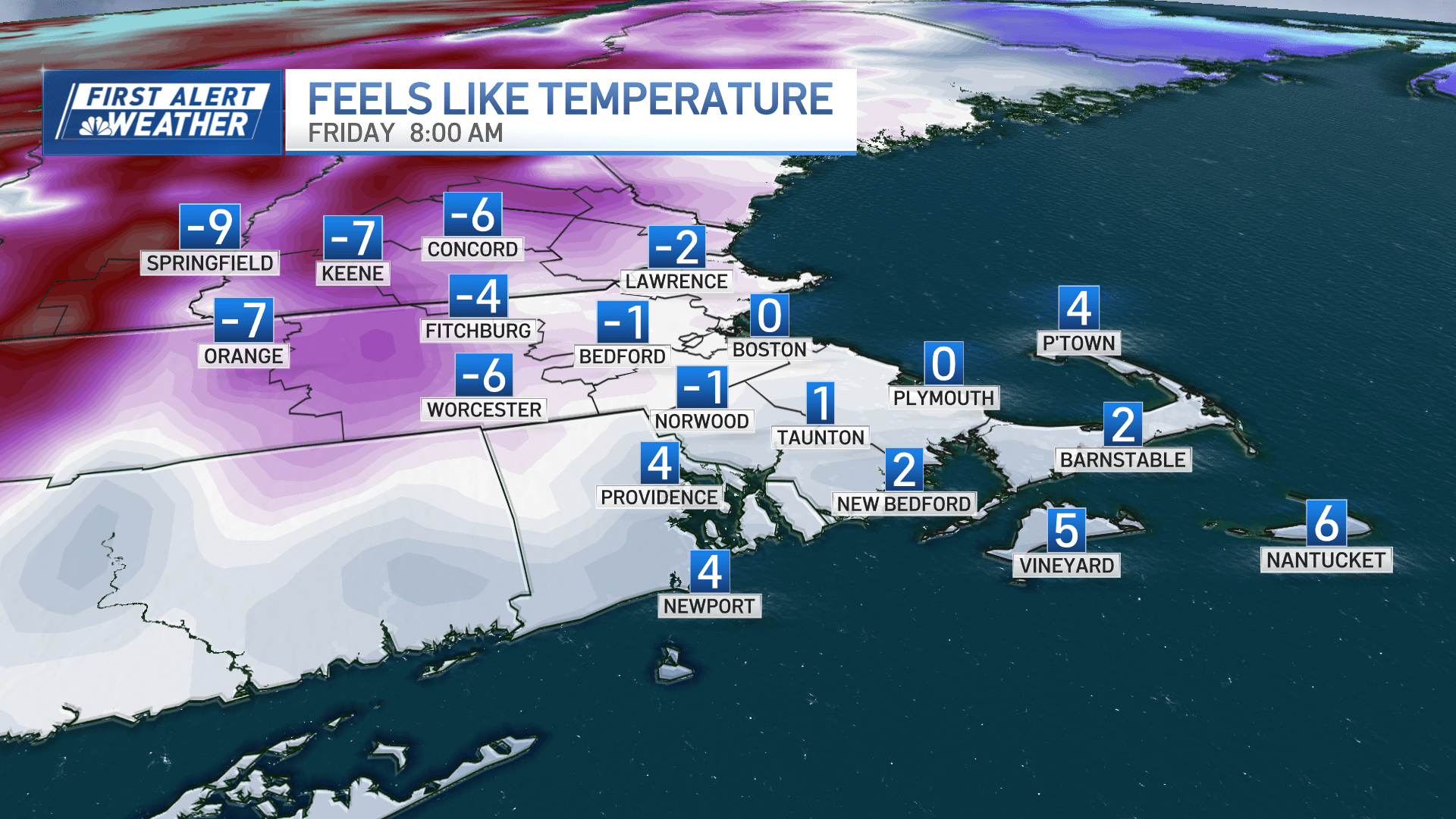
Gusty winds will accompany the cold shot and drive down wind chills to the single digits above and below zero into Friday morning. Remarkably, we will still see highs near freezing on Friday afternoon, with winds backing off considerably.
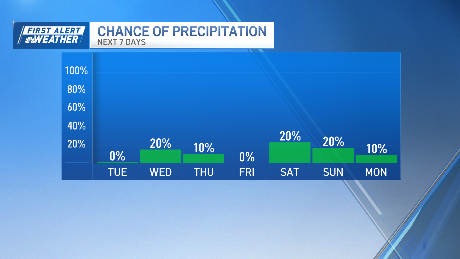
The weekend appears tame with a few sprinkles or snow showers Saturday night and quiet, brighter weather Sunday.
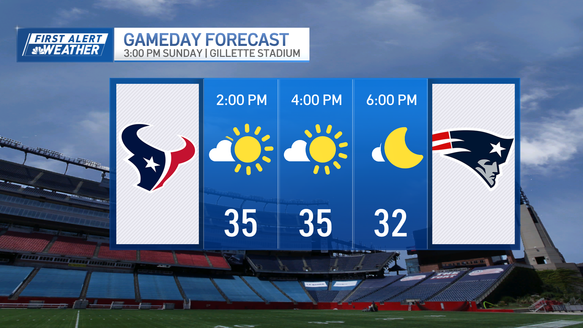
The Patriots game will be chilly with temps in the mid-30s. Wind doesn’t seem to be an issue at this point.
The pattern stays busy next week, but we’ll have a long pause without storms through midweek.
It stays cold and dry with another shift in the storm track by the end of the week. Too soon to speculate about what may get thrown at us, but we’re surely staying vigilant.