

First comes the coldest air of the season and then the weekend wraps with widespread snow storm across New England. Dangerously cold air moves in tonight into Saturday. Wind chills will drop well below zero, with some areas feeling as cold as 10 to 25 degrees below zero. Saturday stays bitterly cold, with highs only in the teens.
Dangerous cold on Saturday


Next up is a winter storm Sunday late morning and all day Monday with a break or two Monday morning, depending on location. Snow develops Sunday morning and becomes heavy by Sunday evening with the highest snow rates expected Sunday evening. Sunday will feature light and fluffy snow that will pile up quickly, highest snowfall rates of 1 to 3 inches per hour are possible late Sunday to Monday. Travel could become very difficult to near impossible at times with severely reduced visibility at the peak of these snow rates.
Snowstorm timeline

Winter storm warnings issued
Winter storm warnings have already been issued for Sunday through Monday for most of southern New England.

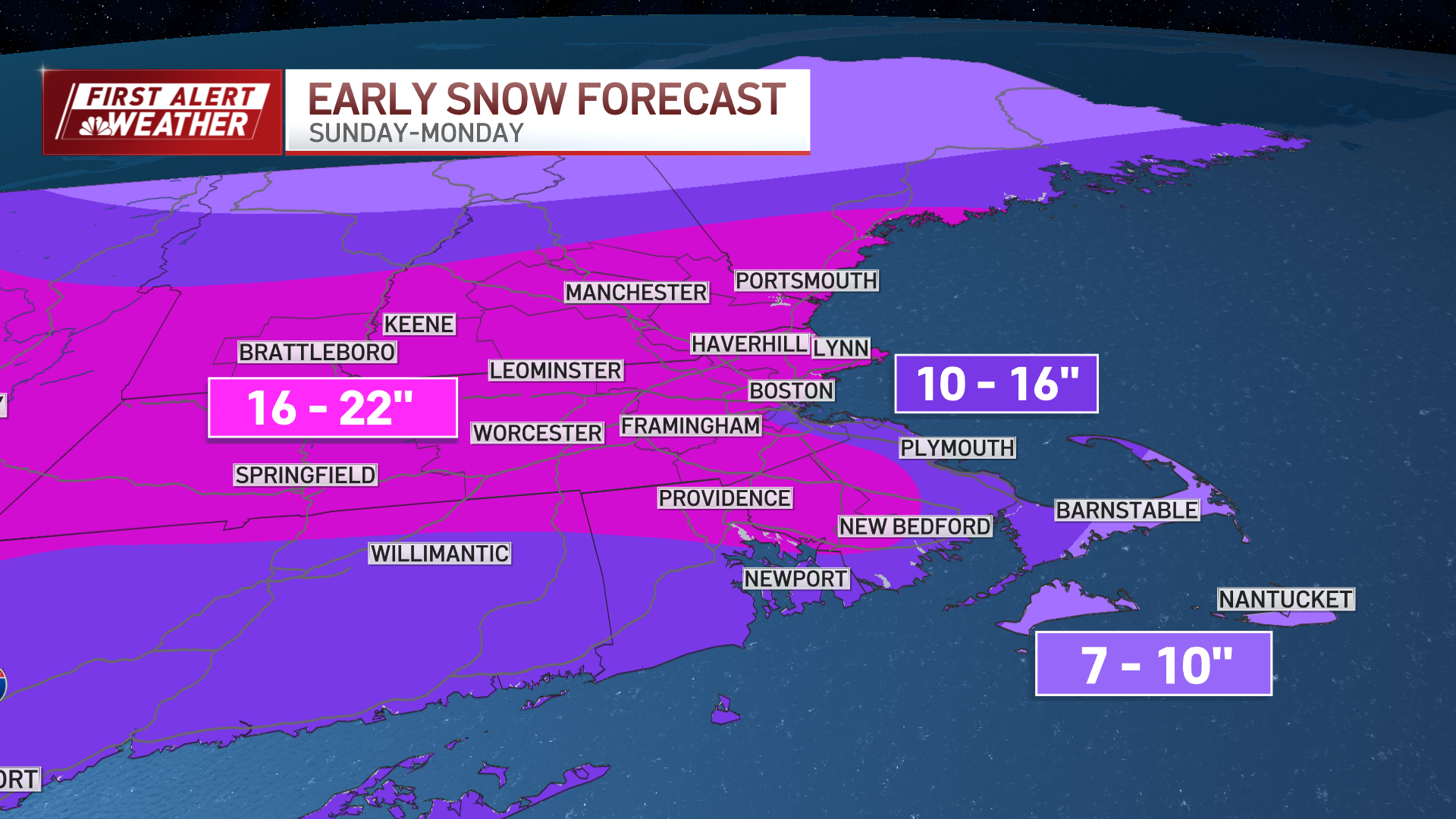
Snowfall totals for New England
Most of the region is expecting 12 to 20 inches of snow, with locally higher totals possible. The South Coast and Cape and Islands will likely see compaction with heavy wet snow and some sleet mix in, which could limit totals there somewhat. Gusty winds may also lead to areas of blowing snow, especially near the coast.
This storm tapers off Monday evening, and cold air settles in for next week.


