We’re cruising right along through this Tuesday with milder temperatures. And the temperatures are getting even warmer tomorrow! Woohoo!

But first, for today, expect highs in the mid 40s under a mix of sun and clouds. The clouds will increase later today in advance of a weather system that could produce an isolated shower or two here and there tonight into Wednesday morning.


We’re not expecting widespread rain in Greater Boston. A few flakes are possible in the higher elevations toward Worcester Hills and the Berkshires. Low temperatures tonight will fall into the mid to upper 30s.
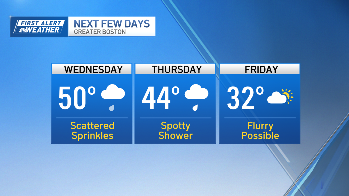
Wednesday will feature a lot of clouds. Again, a few spotty showers are possible. But our temperatures will be the main event. In fact, highs will climb to near 50 degrees!

Enjoy the warmup, because it won’t last. By the time we roll into Thursday, high temperatures will dip into the mid 40s early in the morning. Then, by afternoon, gusty west winds will drop our temperatures even more, into the low to mid 30s. Yikes! Again, a spotty shower is possible, but it will be the exception and not the rule.
On Friday, we’ll wake up to temperatures in the single digits and teens! Highs will reach the low 30s.

Let us know if you see a flurry or two Friday. Seriously! Why, you ask? The threat for snow showers has decreased significantly for the Boston area, as some of our forecast models had originally suggested late last week. So while a few flurries could develop on Friday, we’re not forecasting any accumulations for much of our area.

The higher elevations in Vermont and New Hampshire will see the best chance of accumulating snow. The same goes for Sunday. A few flurries are possible, but right now, we don’t believe we’ll have a snowstorm here in southern New England. We’ll keep you posted on any changes.
Temperatures will fall into the 20s for highs on Martin Luther King Jr. Day on Monday.