
That was a shock to the system right! With wind chill, our temperatures have plummeted by 40 degrees in two days! It’s all thanks to those icy winds. Gusts at Boston Logan Airport nearly topped 50 mph on Friday.
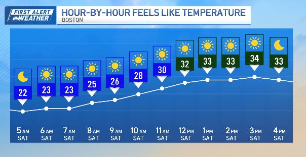
Today, we shake the wind.
Temperatures are still colder than average. But at least we’ll have sunny skies.
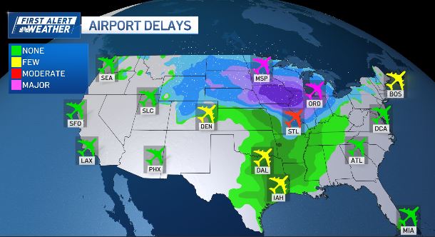
Our next weather maker is winding up over the northern Plains and the Upper Midwest. A foot of snow is possible in Chicago where O’Hare Airport is already in the thick of major delays.
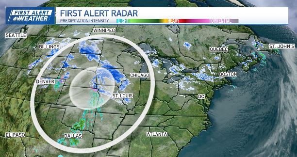
Those delays are now trickling down to Logan Airport. Check your flight status before you leave to avoid any headaches!
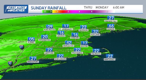
As this disturbance heads east, it will bump into warmer air and bring us rain on Sunday.
Just like last time – the rain is in and out, likely dropping less than 0.25″ for Metro Boston. The rain arrives later in the afternoon on Sunday. It comes and goes by Monday morning. So it will be sun/cloud combo for the commute.
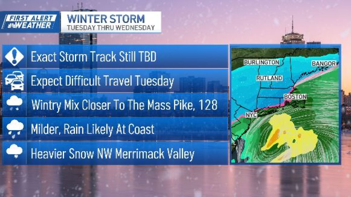
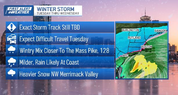
What do we know about Tuesday’s winter storm?
We’ve activated a First Alert day on Tuesday for the incoming storm. We’re still ironing out the specifics, including the exact track of the storm. And that makes all the difference. If the storm wobbles to the north or south – it will mean the difference between rain and snow.
The ocean temperature right now is about 50. That makes it difficult to produce snow at Logan. But for the northwest Merrimack Valley, that’s a zone where we can expect a higher tally of snow.
The bottom line: Expect difficult travel on Tuesday.
Keep checking back with us as we fine tune the forecast.


