4 things to know about the weather:
- Complaint Department: closed
- Perfectly nice Thursday
- Frosty temps start Saturday and Sunday morning
- Next rain at least a week away
The storm that has been sitting a few hundred miles off the Jersey Shore for the last few days has intensified enough to be assigned a name from the National Hurricane Center.
Josephine isn’t a fully tropical system, but it’s enough of a threat to shipping that it is causing issues. The storm is about 250 miles south of Nantucket.
The storm’s northeasterly movement will keep away from land as it heads farther out to sea over the next few days. The storm is generating large waves and rip currents that continue to cause problems along the coast from Cape Cod all the way to the Outer Banks. Beach erosion and rough surf will continue to impact Ocean City and Rehoboth for several more high-tide cycles.
Josephine is the only interesting thing weather-wise that’s happening anywhere near our region. High pressure over eastern Canada will team up with Josephine to send a reinforcing shot of cool air our way for the coming weekend.
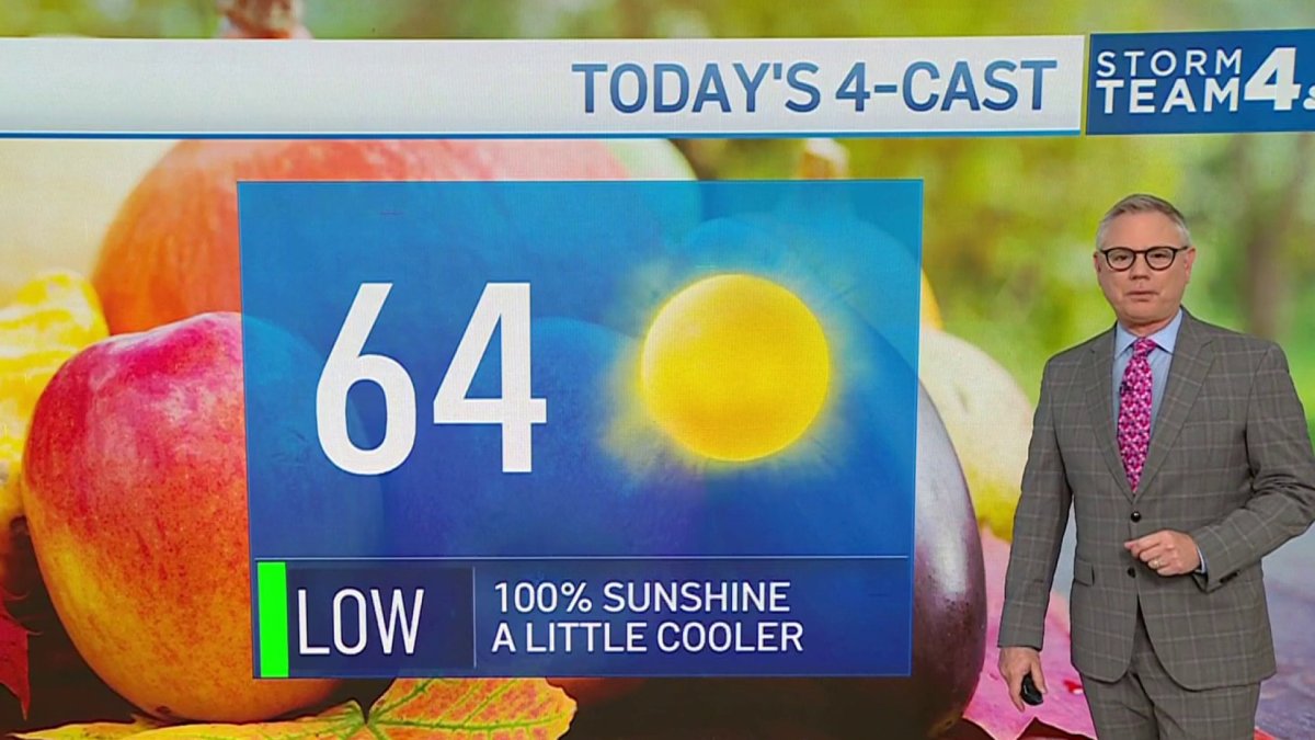
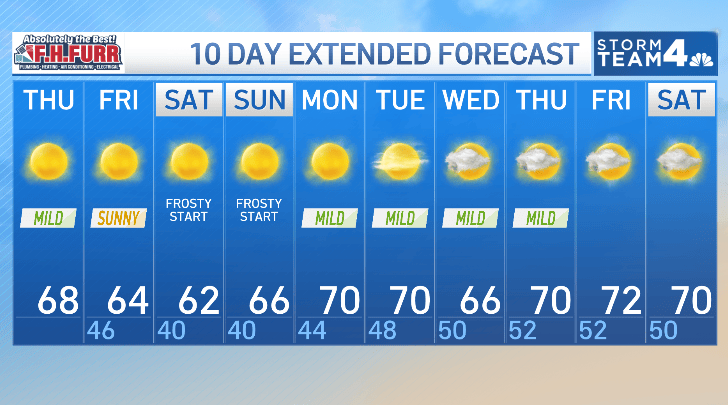
100% sunny skies Thursday afternoon will warm us to near 70°, and clear skies Thursday night will allow most areas to drop into the 40s by Friday morning.
Northeast winds on Friday will hold temperatures down just a bit. We’ll have low to mid-60s for highs.
Friday night into Saturday morning, and Saturday night into Sunday morning will be very chilly, with the risk of frost for everywhere outside the Beltway and away from the Bay. Downtown D.C. and the western shore of the Bay will be near 40° both of those mornings, with low to mid-30s elsewhere.
The good news about the weekend is that both days will be filled with sunshine. Highs will be near 60° on Saturday, and 65° on Sunday.
Next week looks a bit milder, with highs in the low-70s and with dry weather likely to last all the way into Halloween.
Download the NBC Washington app on iOS and Android to check the weather radar on the go.
QuickCast
THURSDAY:
Sunny
Seasonably mild
Breezy at times
Wind: northwest 5-15 mph
Chance of rain: 0%
HIGHS: 65° to 70°
THURSDAY NIGHT:
Clear skies, chilly
Coldest along I-81
Mildest near the Bay
Wind: north 5-10 mph
Chance of rain: 0%
LOWS: 44° to 52°
FRIDAY:
Sunny
Cooler
Steady breeze
Wind: northeast 6-12 mph
Chance of rain: 0%
HIGHS: 60° to 65°
SATURDAY:
AM frost possible
Sunny start to finish
Seasonably cool
Wind: northeast/east 5 mph
Chance of rain: 0%
HIGHS: 58° to 63°
SUNDAY:
AM frost possible
Sunny start to finish
Seasonably cool
Wind: east/southeast 5 mph
Chance of rain: 0%
HIGHS: 60° to 65°
Sunrise: 7:25 a.m. Sunset: 6:20 p.m.
Average High: 67°. Average Low: 50°