4 things to know about the weather:
- Cool, rainy pattern begins
- Grab the umbrella
- Unpack the sweatshirts
- No sunshine until Friday
Summer is over in every sense of the word.
These first three weeks of September have been about 3-4° warmer than average, with slightly below average rainfall. Starting Monday, we begin catching up on rainfall, and the next 10-14 days all will be cooler than average.
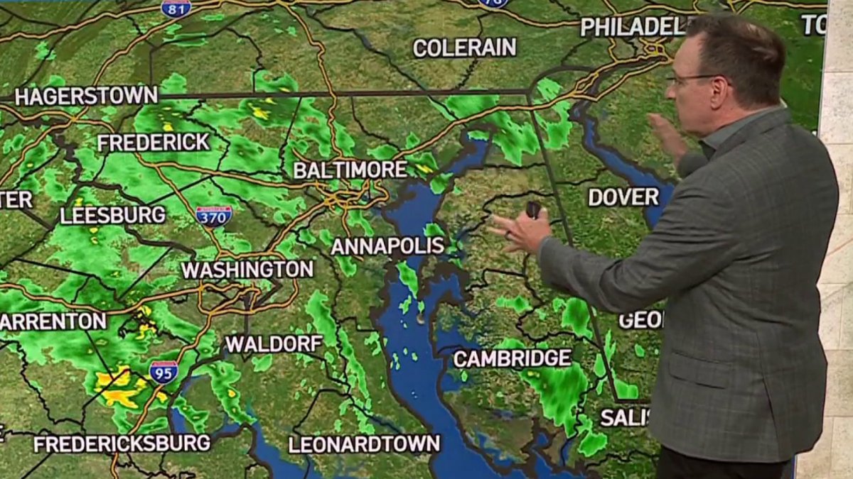
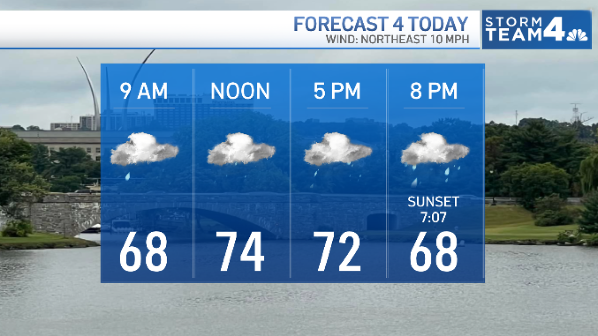
Rain moved in from the east by about 2:30 p.m. Monday and will continue through the evening rush hour. heavier rain will fall to the south.
Download the NBC Washington app on iOS and Android to check the weather radar on the go.
Rainy fall weather
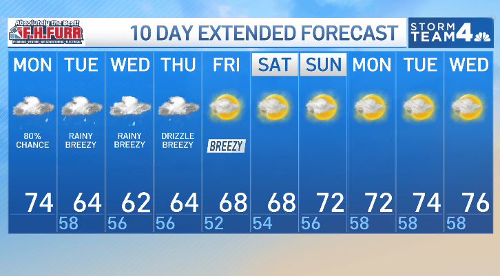
In addition to the thick clouds and high rain chances, Tuesday, Wednesday and Thursday all will be unusually cool.
Winds of 20-30 mph will combine with the clouds and rain to hold afternoon highs close to 60° through the week — almost 20° below average.
Rain will be light-to-moderate — steady at times — but no severe weather is in this weeks forecast.
Expect 2-3 inches of rain through Thursday, but flooding is not a concern.
QuickCast
MONDAY NIGHT:
Cloudy skies
Rain, moderate at times
Rainfall around 1/4”
Wind: northeast 10 mph
Chance of rain: 100%
LOWS: 58° to 65°
TUESDAY:
Cool, wet and breezy
Steady, moderate rain
Rainfall over 1/2”
Wind: northeast 14-28 mph
Chance of rain: 100%
HIGHS: 62° to 67°
WEDNESDAY:
Chilly, wet and breezy
Frequent showers
Rainfall around 1/4”
Wind: northeast 12-24 mph
Chance of rain: 100%
HIGHS: 56° to 63°
THURSDAY:
Cloudy, cool and breezy
AM: showers, drizzle
PM: mist, drizzle
Wind: northeast 12-24 mph
Chance of rain: 80%
HIGHS: 60° to 65°
Sunrise: 6:55 Sunset: 7:07
Average High: 79° Average Low: 62°