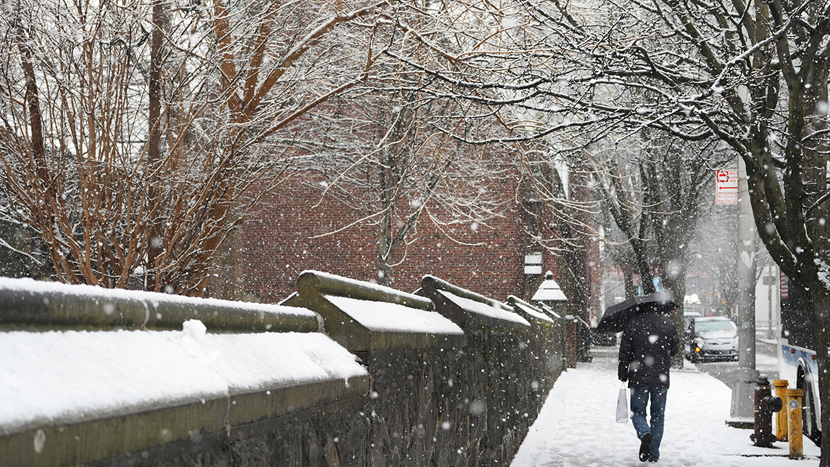
All the focus is on the weekend storm, but for the here and now, it’s a small window of milder air. After a small batch of overnight snow, we’re waking to much more tolerable temperatures. We push the numbers into the low 40s this afternoon with a pleasant blend of clouds and sun.
School closings and delays
There are a number of school delays in Connecticut this morning, and a handful in Massachusetts, including Worcester Public Schools, due to the overnight snow.
Click here for a list of school delays
Extreme cold is coming
Colder air moves in tonight, but we’ll hang on by our toenails to highs near freezing tomorrow. Numbing air is our fate, however. Temperatures will crash after sunset as arctic air sweeps in from the west.
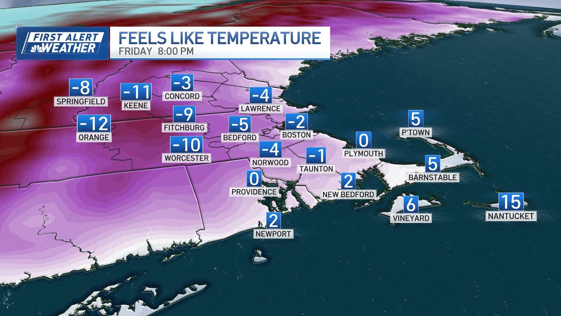
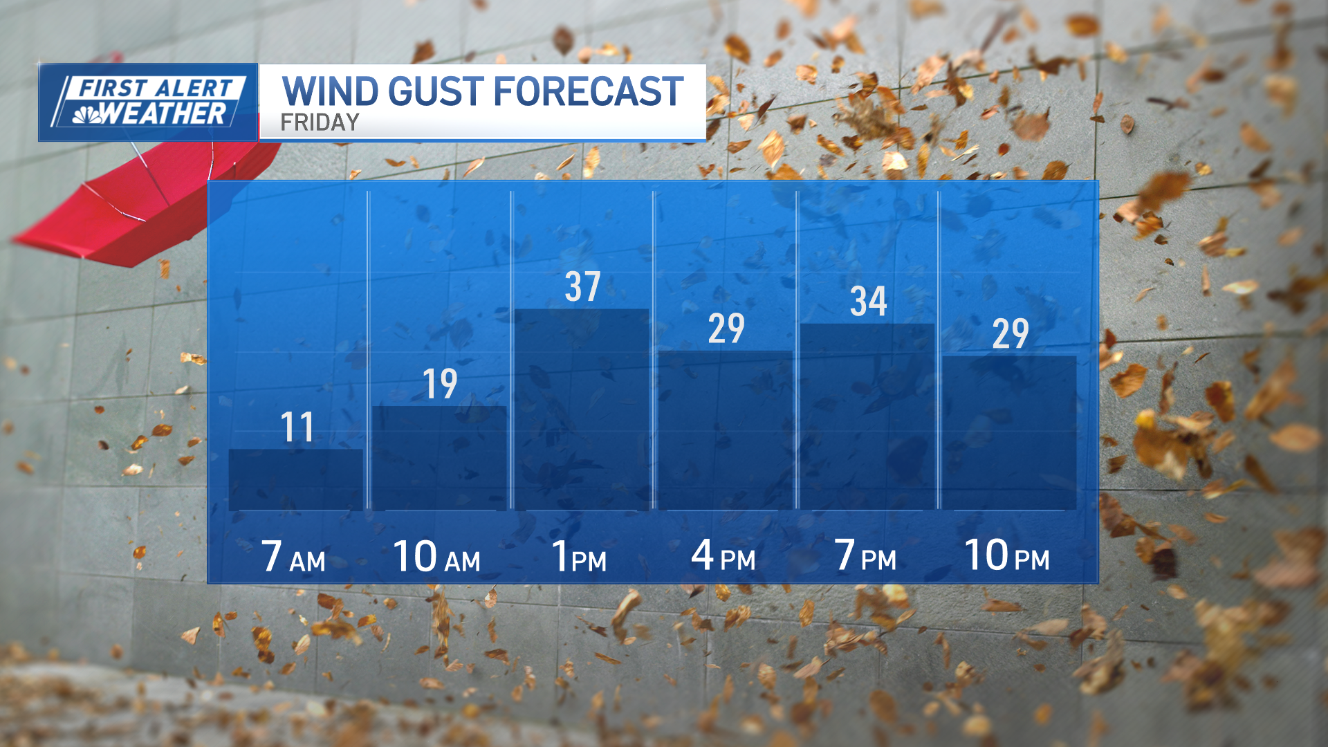
Bitterly cold wind chills set in Friday night as winds gust over 30 mph in spots. This is the frigid setup for the weekend storm.
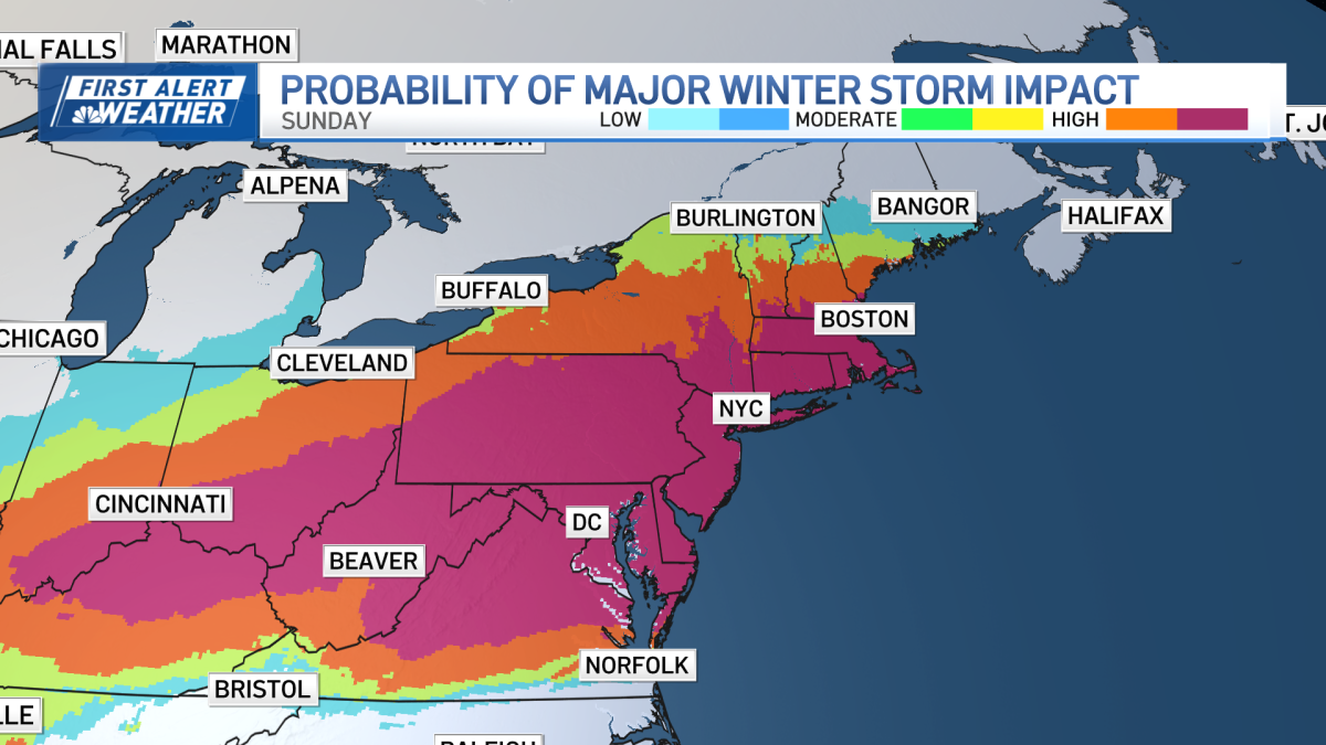
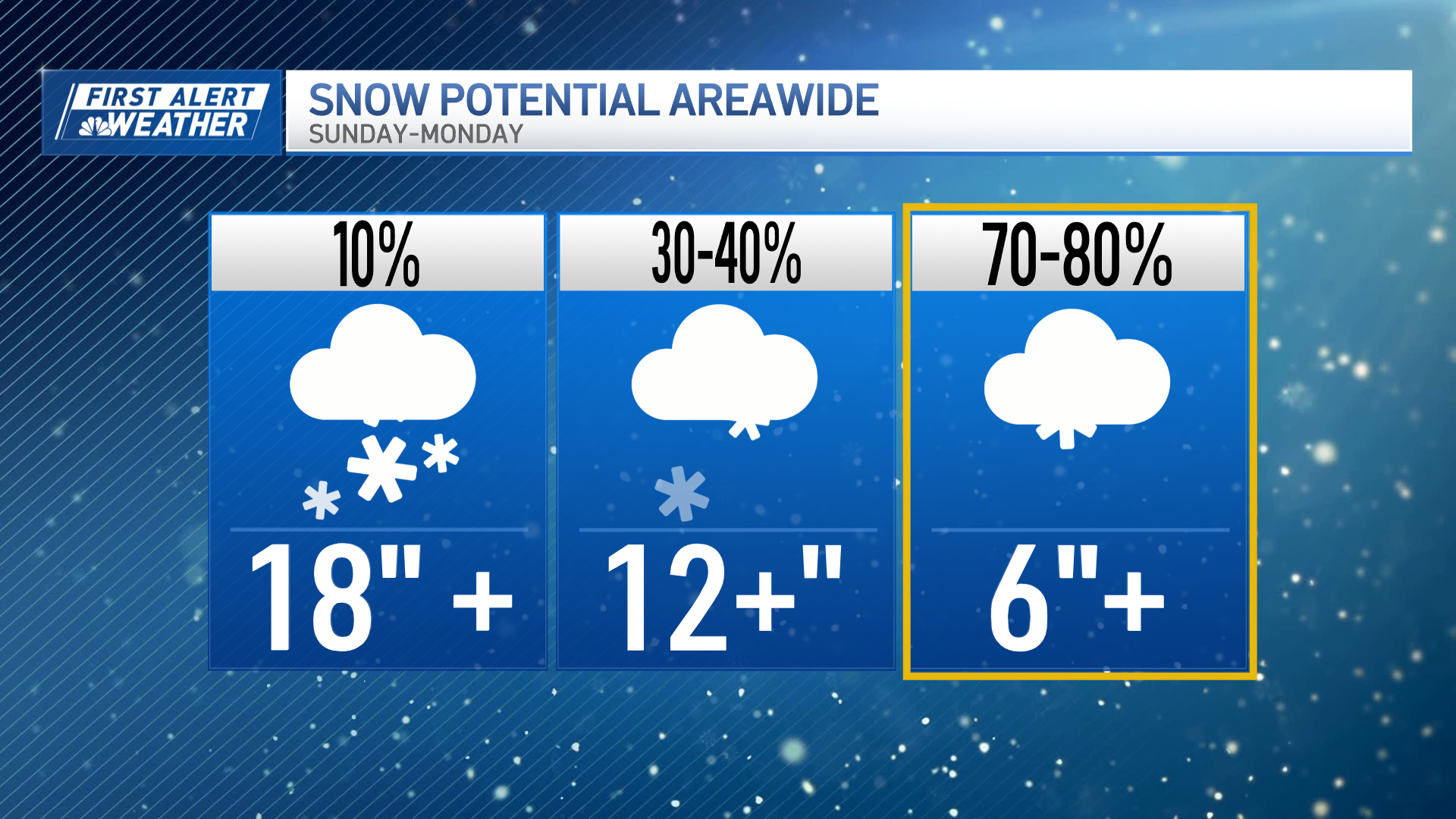
Major snowstorm this weekend
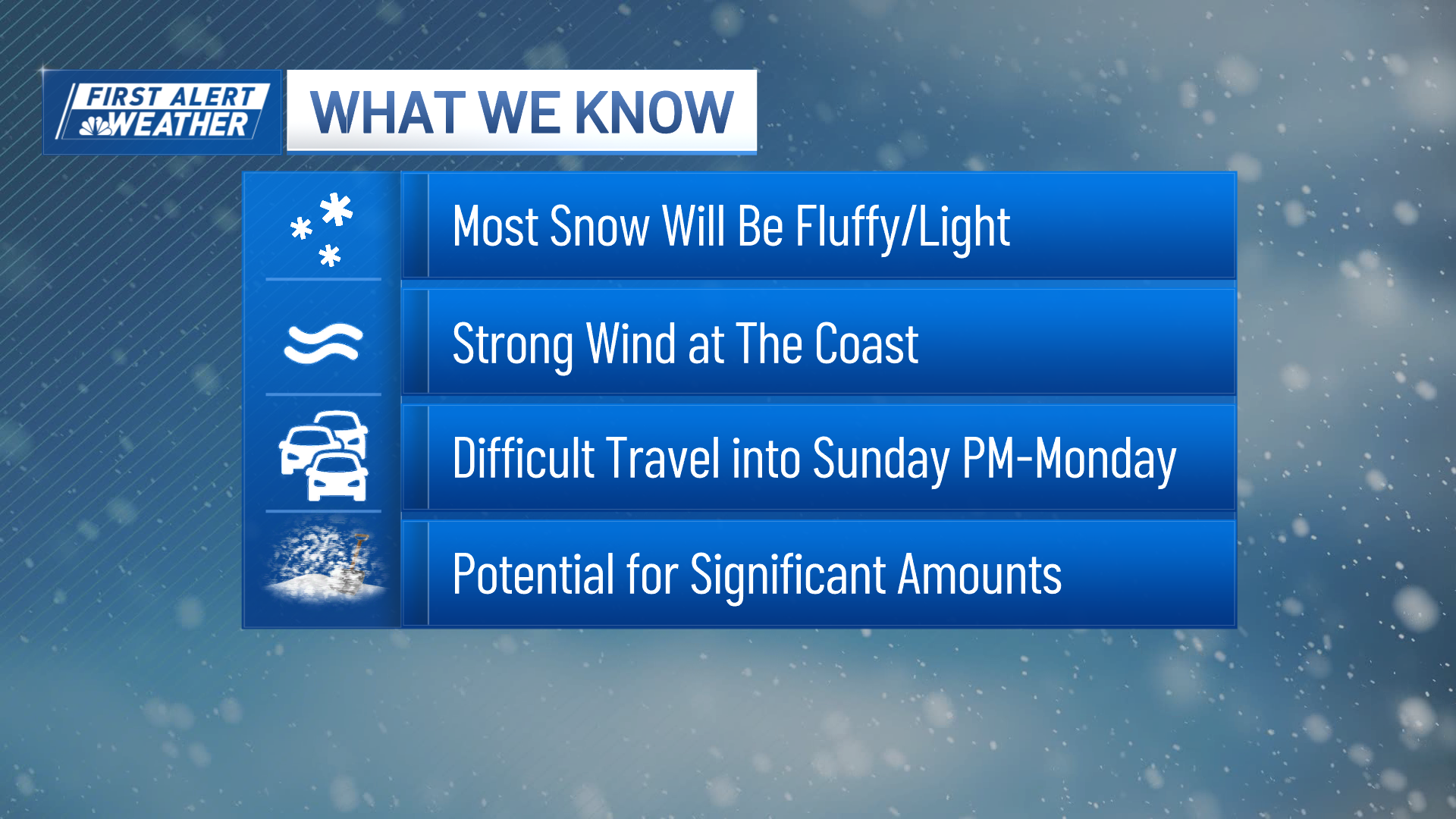
We’re still wrestling with the finer details, but it appears we will get a major snowstorm Sunday into Monday.
Click here for active weather alerts
There will be travel impacts
We know there’s a great deal of travel impact locally (roads) and regionally (airports). If you have flights you can reschedule, now might be a good time to do that. Local roads may become difficult to navigate later Sunday as snowfall rates (how quickly the snow piles up) and winds increase – especially along the coast. This does not look like a blizzard, but it may be hard to get around during the height of the storm. Which, along with specific snowfall amounts, is one of the things we’re working on in the coming days.
Storm timing
We are fairly certain of the timing (early Sunday) and the finish (early Monday), but peak storm intensity could waver by a few hours.
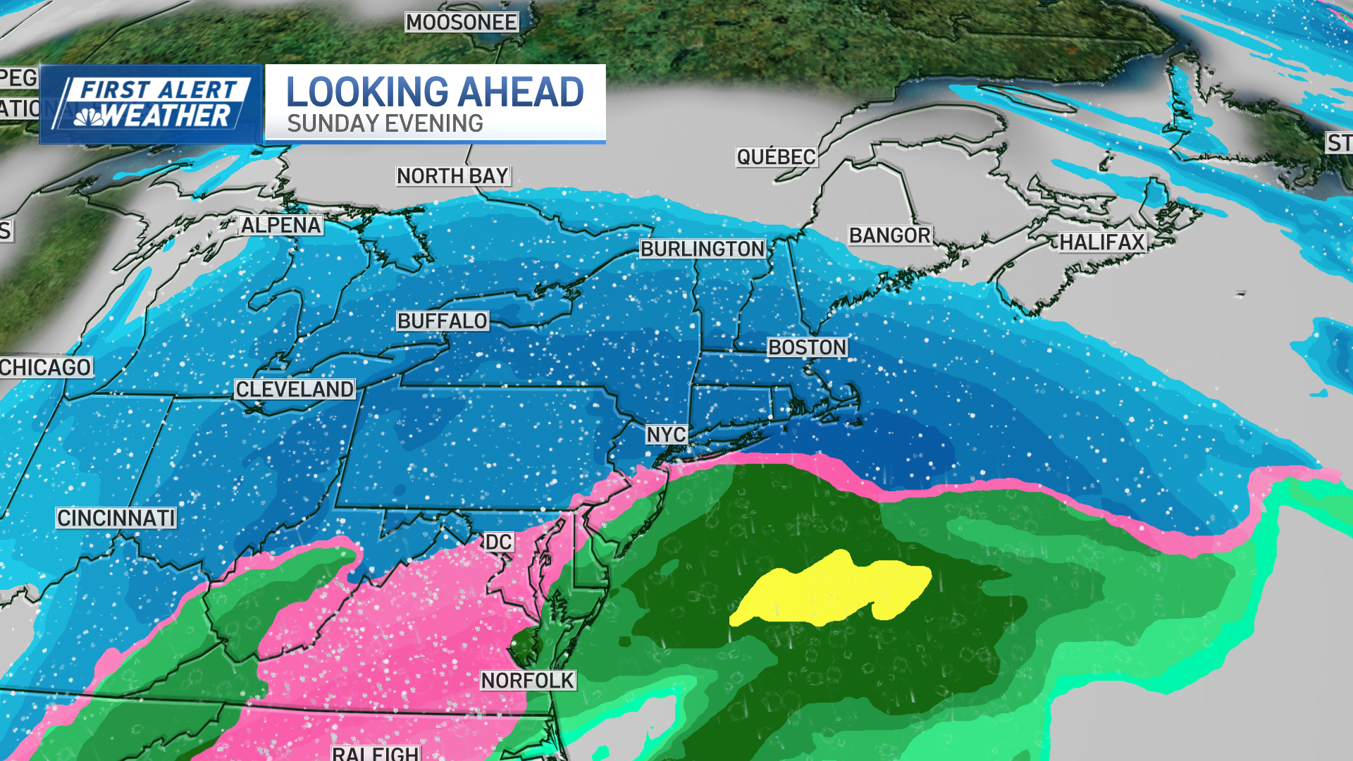
How much snow will we see in New England?
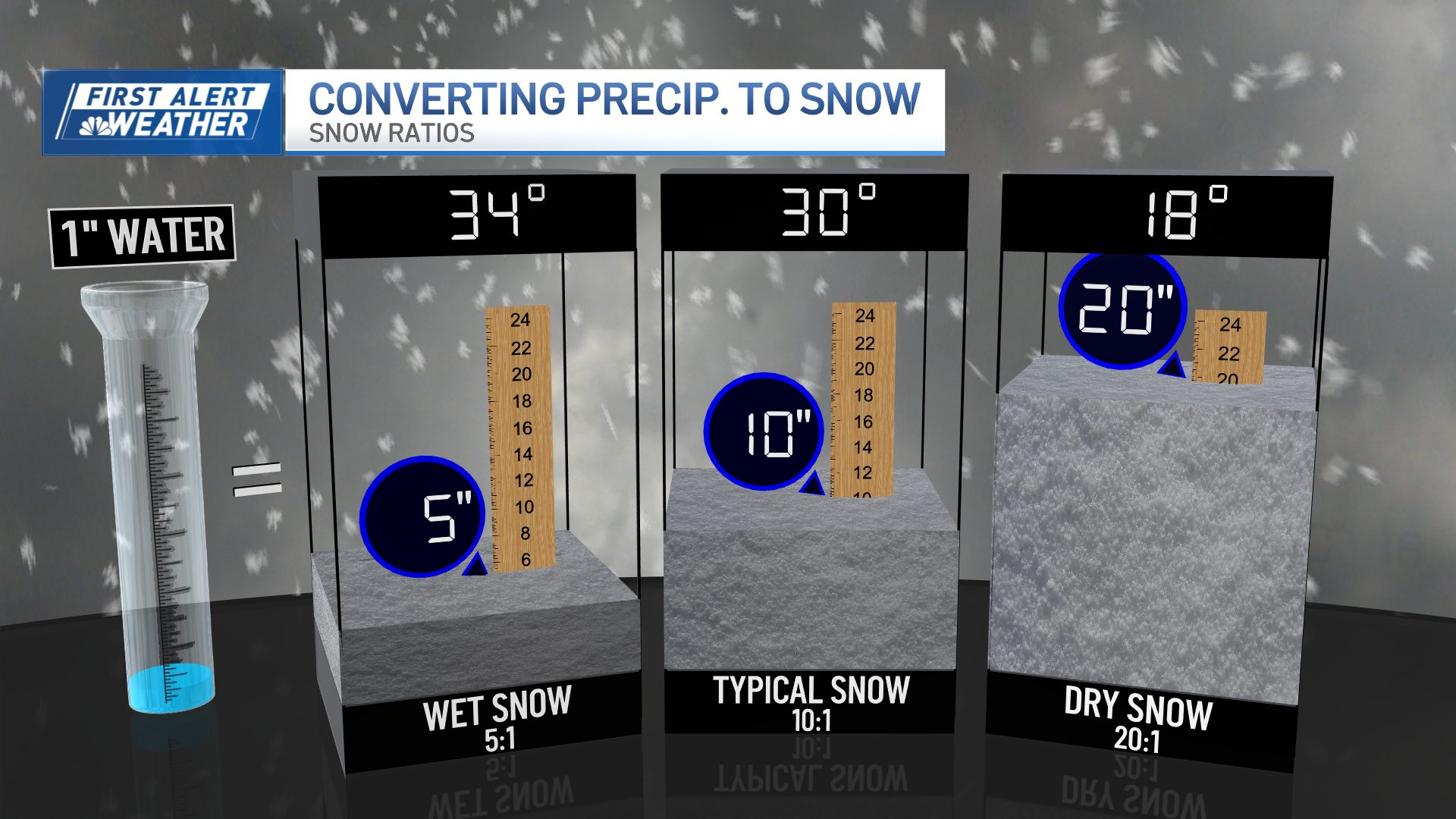
Generally, this is a 6+ inch snowfall, with the possibility of a foot in spots. Snow consistency will be fluffy, but along the coast could become sticky as the temperatures rise.
Where the coastal front (boundary between temps in the teens and temps in 30s) sets up is also one of the major forecast details to iron out.
So there you have it. We’re following the latest guidance – and draw on past experiences with this kind of setup – to bring you the latest.