Now is the time to start planning ahead for some incredibly impactful weather here in southern New England this weekend into early next week. Not only are we tracking dangerously cold temperatures, but we’re also tracking one of the biggest snow storms to impact Greater Boston in several years.

Dangerously cold weather
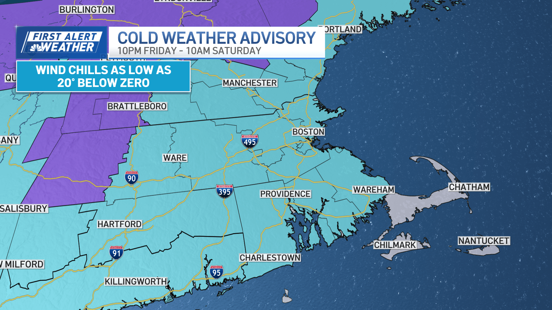
Arctic air will rush into our region beginning Friday evening, giving way to feels-like temperatures well below zero! In fact, a Cold Weather Advisory is in effect for our area from Friday night through Saturday morning. Wind chill values could fall as low as 20 degrees below zero! That’s weather that you don’t want to play with. Care for your pets, plants, the pipes around your home and your elderly neighbors. Actual morning temperatures on Saturday will be in the single digits. High temperatures will rise into the mid-teens. Sunday morning will also be cold with temperatures in the single digits. High temperatures will rise into the 20s by afternoon.
Impactful snow heading our way
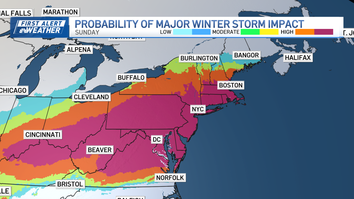
We’re keeping a close eye on a winter storm that will impact southern New England, including Boston, from Sunday to Monday with several inches of snow.
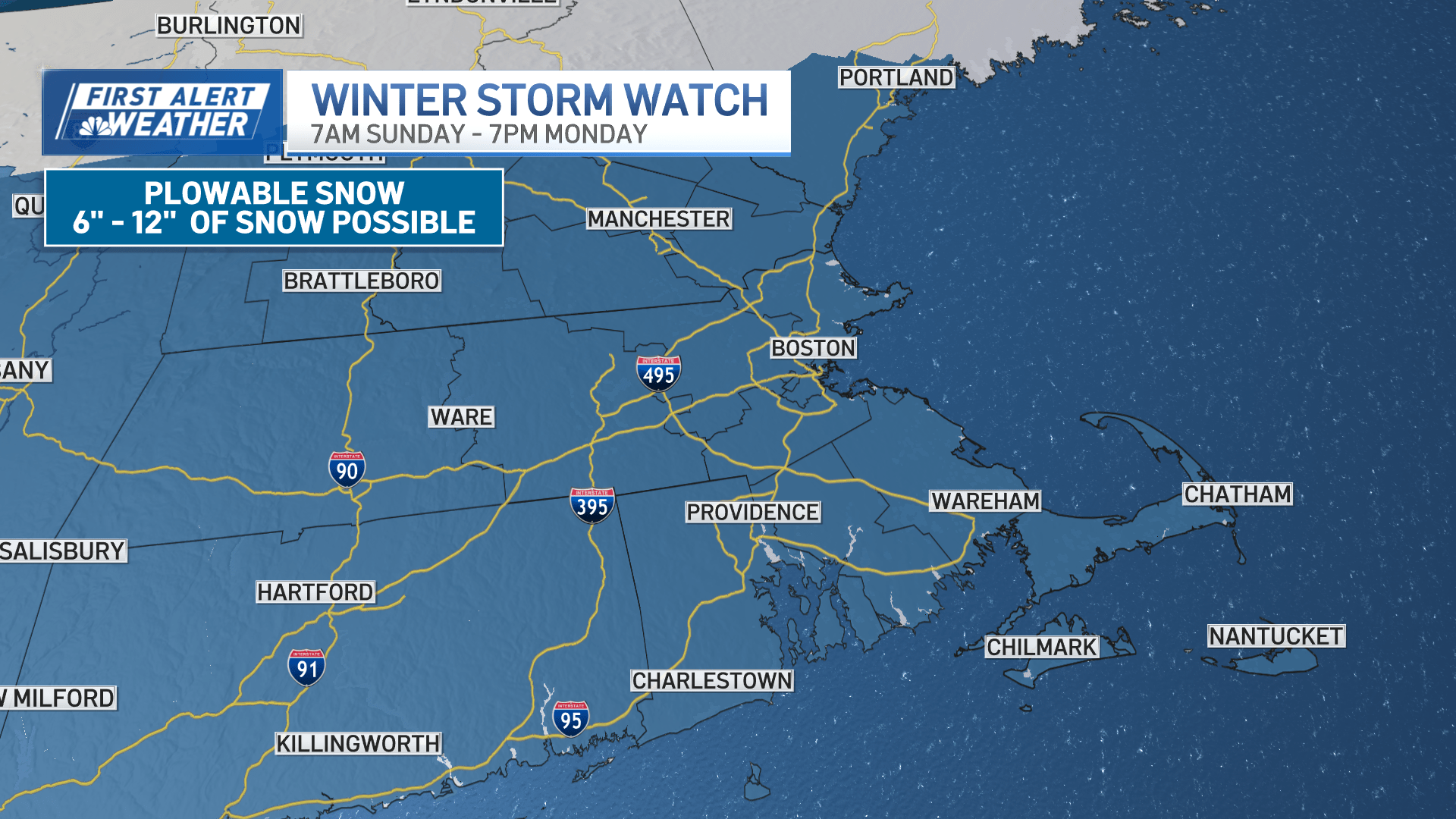
A Winter Storm Watch is in effect for much of our area from Sunday morning through Monday evening.
Breaking down the storm
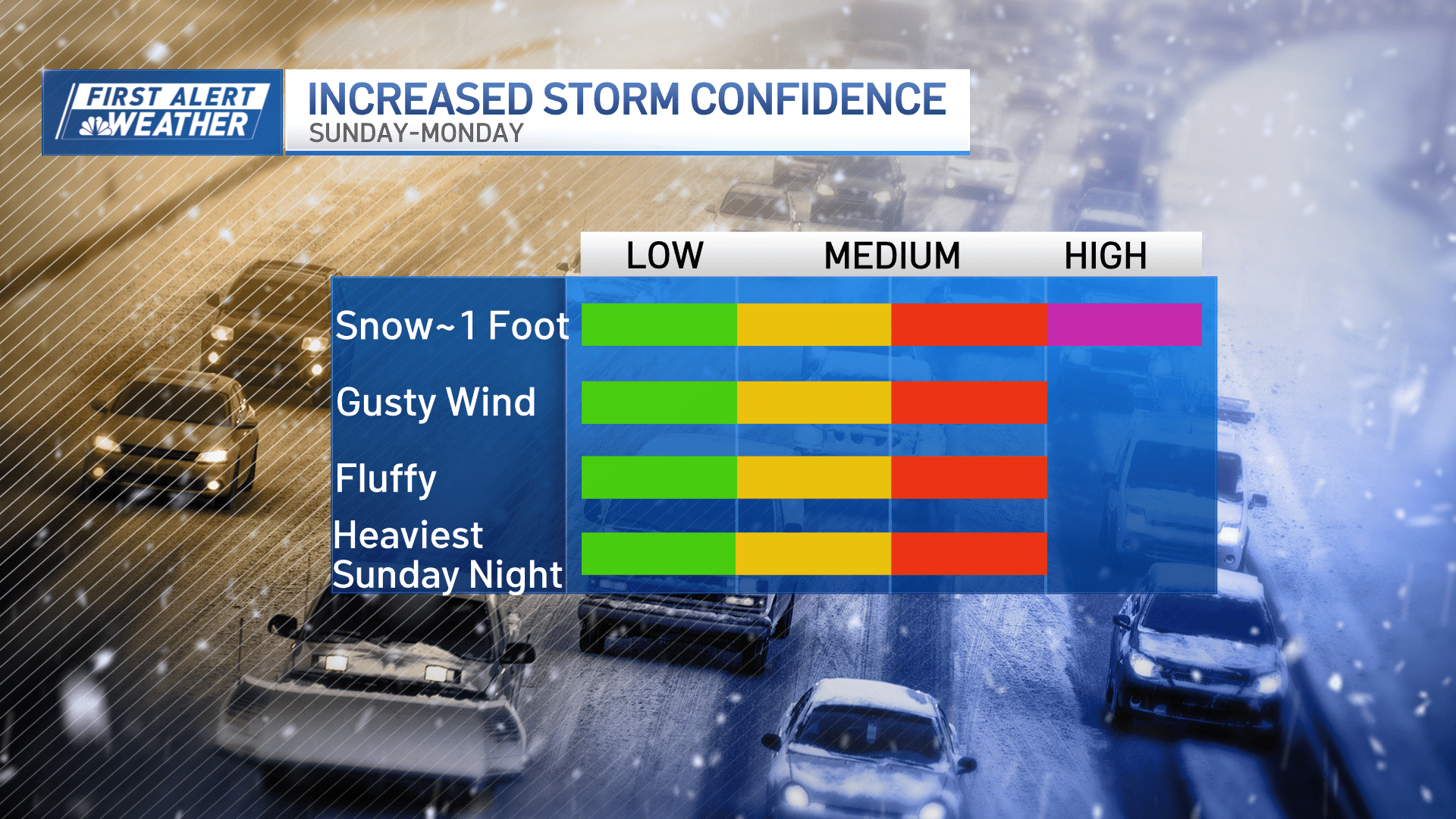
Not much has changed with our forecast thinking. In fact, our model guidance has stayed fairly consistent, bringing a high probability of seeing more than 6 inches of snow for our area, starting Sunday. And within that realm, it’s not out of the question for parts of central and eastern Massachusetts to see up to 12 inches of snow. Some locally higher amounts are also possible.
The storm’s track will ultimately determine how much snow the Greater Boston area could see. The only exceptions to these potential snow totals are the Cape and Islands. Some warmer air might intrude, chipping away at the full snow potential. So, for now, the Cape and Islands will likely see less than a foot of snow.
Track the snowstorm with live radar
Still, though, much of our area will see plowable snow Sunday through Monday. The snow will make travel difficult. We expect the worst of this storm to impact our area overnight Sunday into Monday morning.
Some gusty winds are also possible, especially along the coast, with gusts up to 30 mph. Again, snow amounts and potential impacts could change depending on the storm’s track, so stay tuned.