4 things to know about the weather:
- Nice & warm Thursday
- Isaias intensifying
- D.C. area is dry until Sunday
- Locally heavy rain possible
Isaias became a hurricane early Thursday morning. The storm was about 500 miles south of Mobile, Alabama, early Thursday morning and will be moving in that direction until it makes landfall somewhere near there late Friday evening.
Hurricane warnings have been posted from Biloxi, Mississippi, to Pensacola, Florida. Major travel disruptions are likely to last from Friday afternoon into Sunday across much of the Deep South.
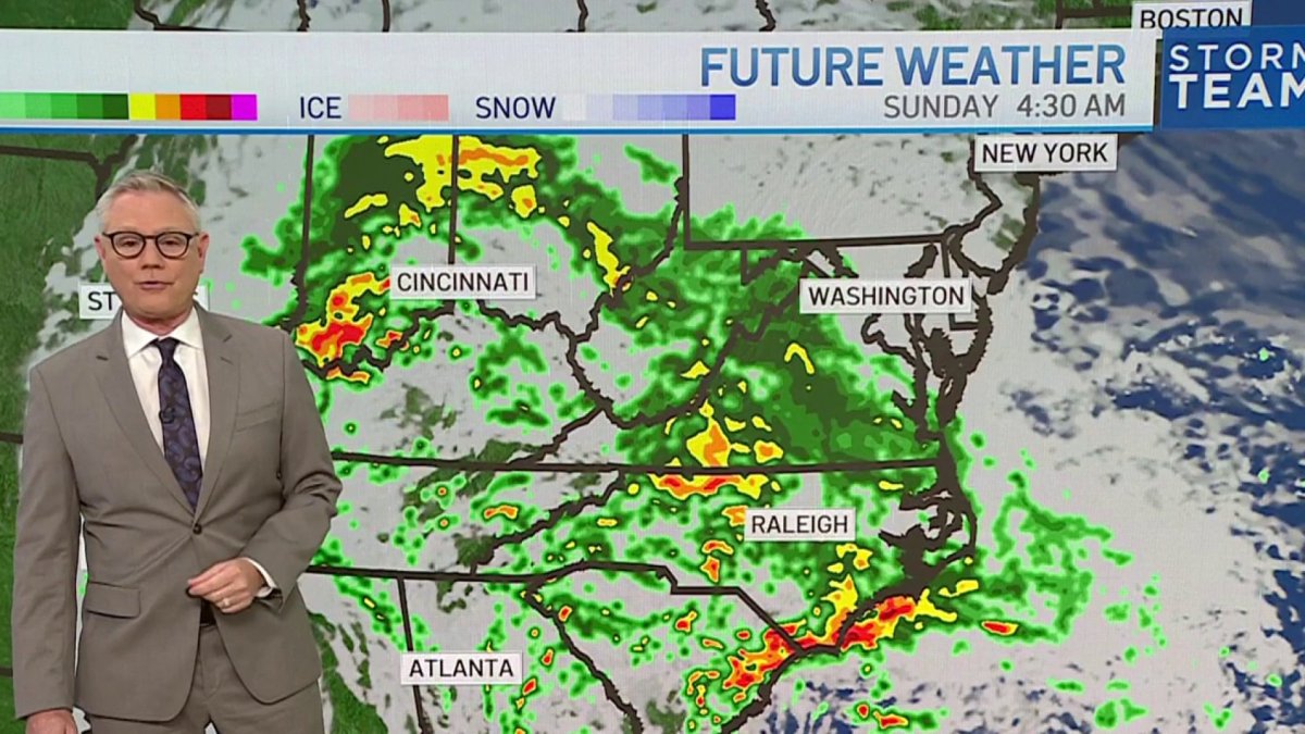
The remnants of Isaias will be in western Tennessee by Saturday evening before being pushed eastward, in our direction, on Sunday.
Dry and warm in DC area
Back here at home, we have three more full days of dry weather.
There is still not much confidence in exactly how much rain Isaias’ remnants will bring to the mid-Atlantic but there’s certainly the risk of getting as much as 1 to 3 inches.
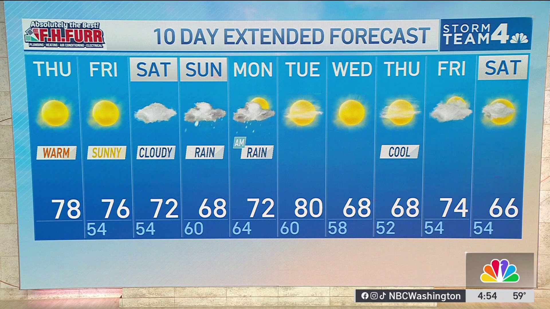
Take a little time between now and Saturday evening to insure your property is ready for heavy rain. Clean out gutters and storm drains. We’ll be nice and sunny today with highs in the mid-to-upper 70s.
Northwest winds will pick up Thursday afternoon as a weak cold front passes through. Friday will be sunny and about 5° cooler than Thursday.
Download the NBC Washington app on iOS and Android to check the weather radar on the go.
How Hurricane Isaias will affect the DC area this weekend
Clouds from Isaias will arrive Saturday, with highs staying in the low 70s. All in all, it’ll be a nice, easy day for errand running and yard work.
Rain is expected to arrive at some point Sunday morning. The Commanders game at 1 p.m. Sunday is likely to be wet, with temperatures in the mid-60s. If we’re going to get any heavy rain from Isaias, the most likely time for that will be Sunday evening and overnight.
Rain totals from the storm should be in the 0.75-1.5″ range, but tropical systems cannot be trusted, so it’s safest to prepare for more and hope for less. The rain will end Monday morning, and the sun should return during the afternoon.
From Tuesday onward, the rest of next week looks to be dry. Tuesday has a chance to be quite warm, in the low 80s, before cooler air bring highs in the 60s starting next Wednesday.
QuickCast
THURSDAY:
Mostly sunny
Nice and warm
Breezy at times
Wind: northwest 10-18 mph
Chance of rain: 0%
Highs: 75° to 80°
THURSDAY NIGHT:
Clear evening
Some overnight clouds
Cool and dry
Wind: northwest 5 mph
Chance of rain: 0%
Lows: 48° to 56°
FRIDAY:
Mostly sunny
A bit cooler
Low humidity
Wind: northwest 5-10 mph
Chance of rain: 0%
Highs: 68° to 74°
SATURDAY:
Increasing clouds
A bit more humid
Remaining dry
Wind: southeast 5-10 mph
Chance of rain: 0%
Highs: 68° to 73°
SUNDAY:
Cloudy and breezy
Rain likely after 9 a.m.
Heavier rain after sunset
Wind: southeast 15-25 mph
Chance of rain: 80%
Highs: 63° to 68°
Sunrise: 7:10 a.m. // Sunset: 6:40 p.m.
Average high: 72° // Average low: 55°