4 things to know about the weather:
- Here comes the sun
- Frost in the mountains
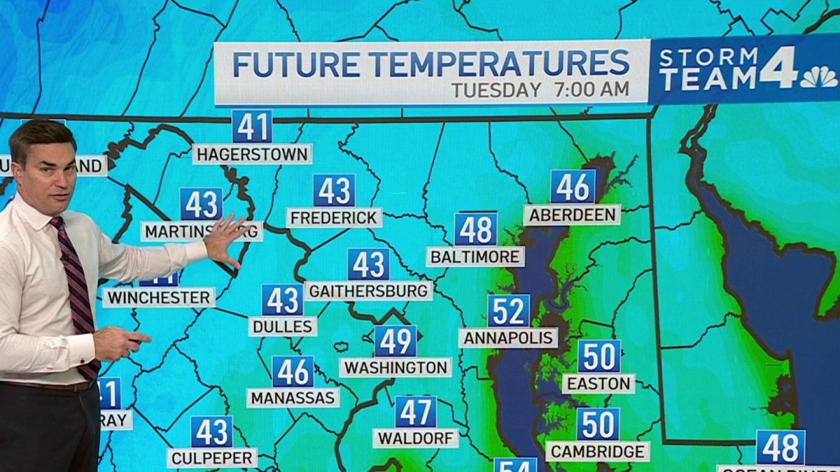
- Chilly mornings, blue skies in the afternoons
- Next rain 7-8 days away
After a very active and generally cloudy, rainy pattern these past two weeks, we’ve certainly earned a week of quiet fall weather. Our skies turned sparkling blue for Monday afternoon, and you can expect more of the same every afternoon all week as high pressure keeps the region beautiful.
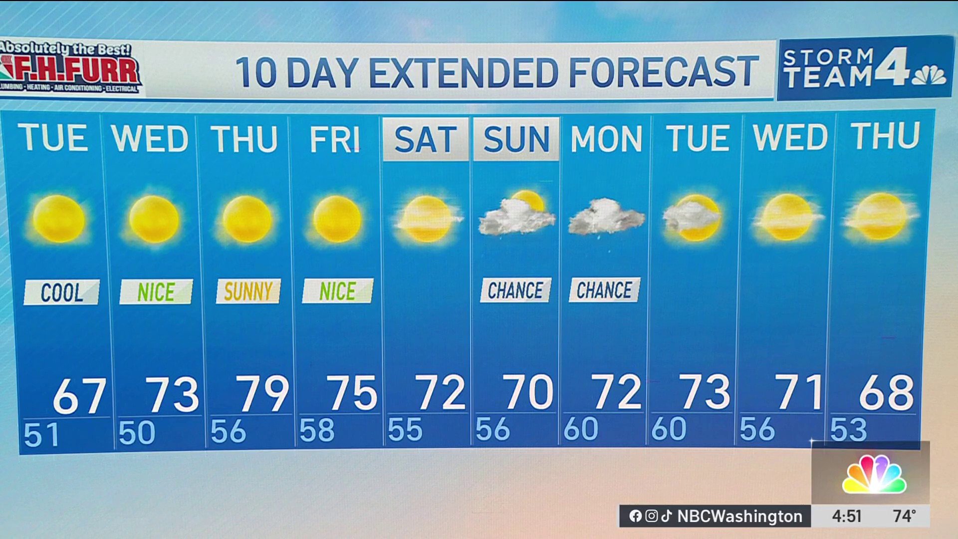
Tuesday will start chilly with temperatures around 50, warming up to the mid-60s in the afternoon. Expect gusty conditions.
Wednesday will be warmer but still cool with highs in the low-70s.
Storm Team4 predicted last week that frost would be a possibility Monday night and Tuesday night, and frost advisories have already been issued for far western Maryland and the Allegheny mountains in West Virginia for Monday night. Those advisories could be expanded to include parts of eastern West Virginia, northern Maryland and the Shenandoah Valley for either Monday night or, more likely, Tuesday night.
Thursday looks sunny and warm, with highs around 80°.
Friday will be delightfully sunny with highs mostly in the mid-70s.
Download the NBC Washington app on iOS and Android to check the weather radar on the go.
QuickCast
MONDAY NIGHT:
Clear, very chilly
Coldest along, west of I-81
Mildest in city centers and near the bay
Wind: northwest 5-10 mph
Chance of rain: 0%
Lows: 38° to 50°
TUESDAY:
Another chilly start
Sunny skies
Crisp and cool
Gusty
High: 66°
WEDNESDAY:
Sunny and cool
High: 72°
THURSDAY:
Mostly sunny
Nice and warm
High: 80°
Sunrise: 7:08 a.m. // Sunset: 6:44 p.m.
Average high: 74° // Average low: 57°