We’ve issued First Alert weather days on Sunday and Monday for a significant snowstorm that is approaching us from the south. Here’s the latest on the storm’s timing, track and potential snowfall totals.
Morning guidance:
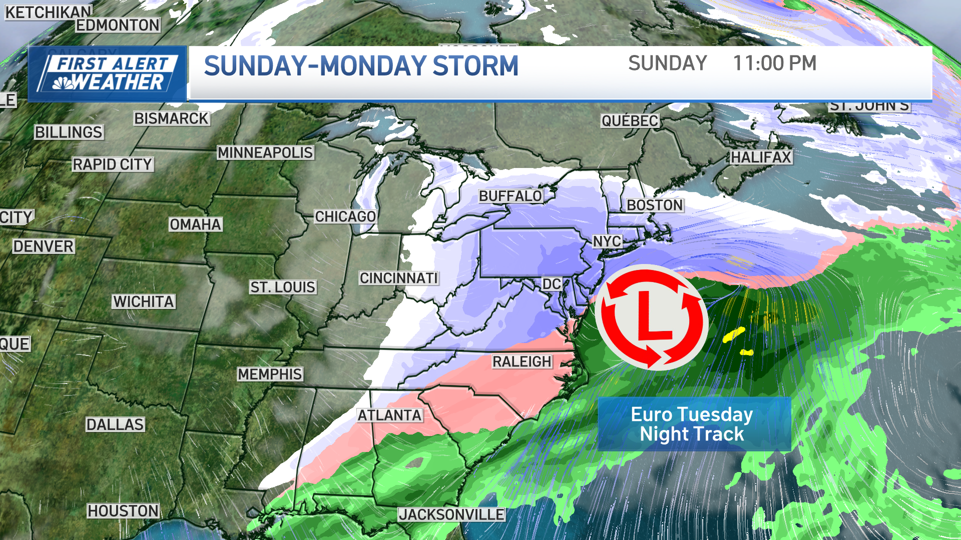
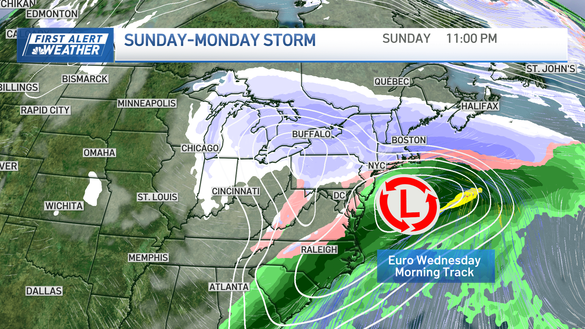
Our models have shifted north since Tuesday night, and the main players are in surprising agreement as of Wednesday morning. The low pressure center and developing coastal low is also looking slightly stronger and near the “benchmark” for Sunday night into predawn Monday.


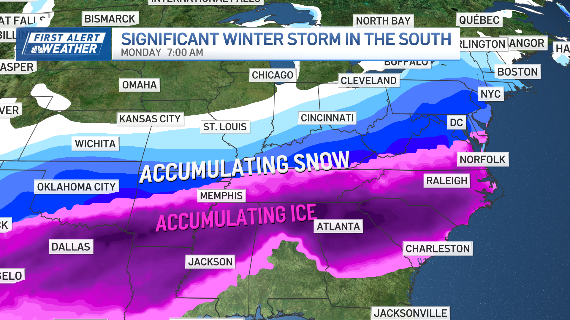
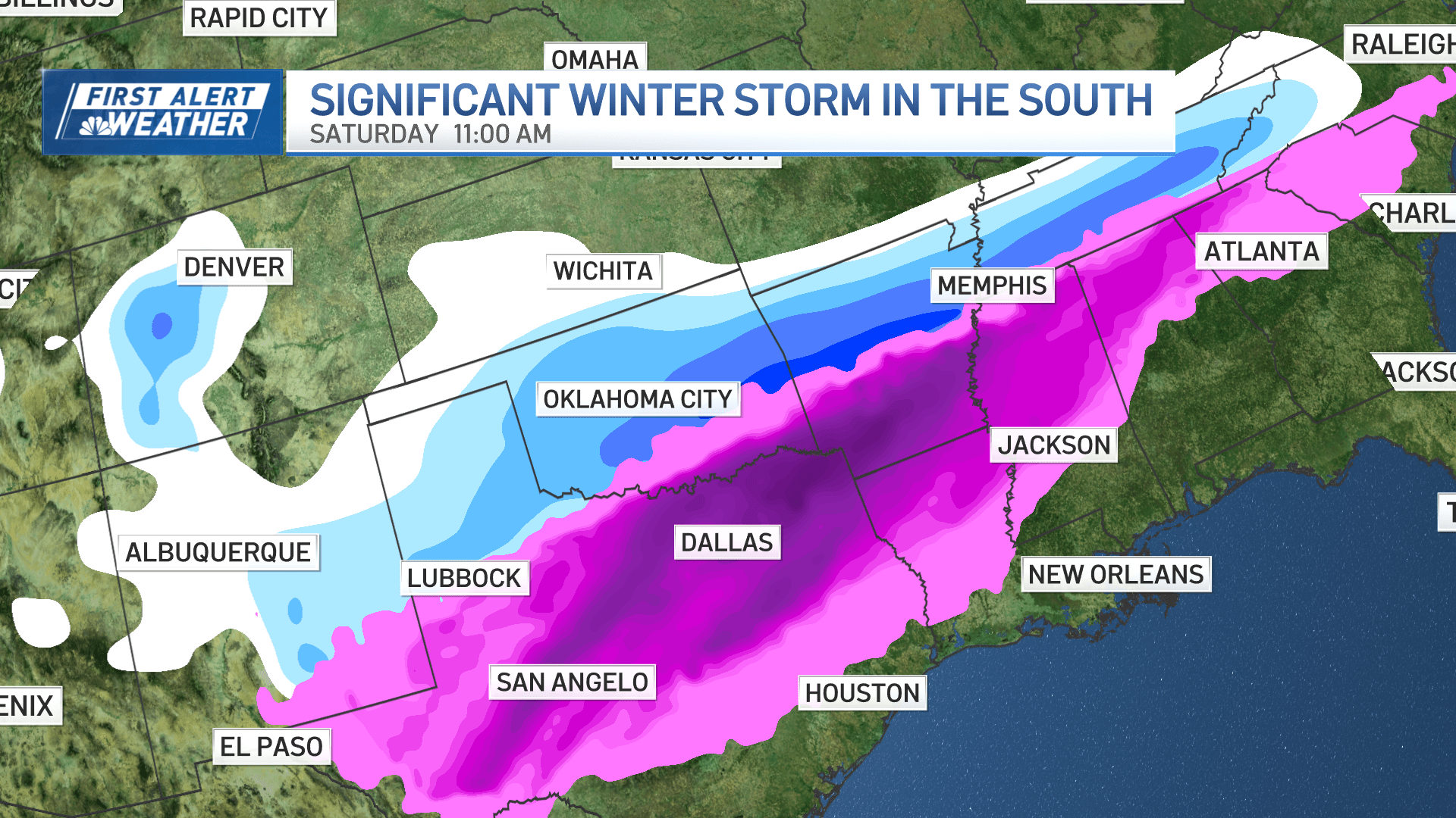
A major ice storm is setting up across the Deep South, from Texas through the southeastern U.S. There’s still uncertainty at exactly where the changeover to rain will be near the Gulf Coast, plus who will see ice versus snow across the Midwest and Ohio River Valley.
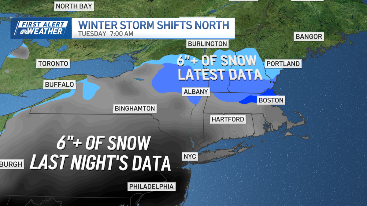
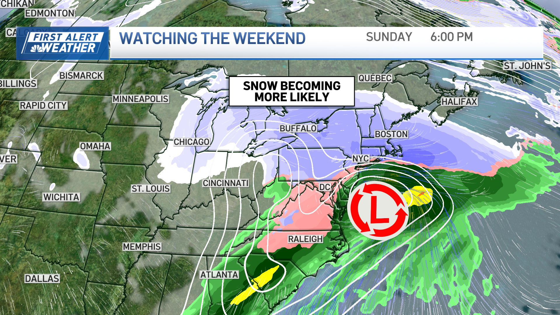
The snow chances for New England to New York have increased significantly in the last 24 hours. Our probability of 6 inches of snow or more for Boston has increased to now a 40% to 60% chance Sunday into Monday.
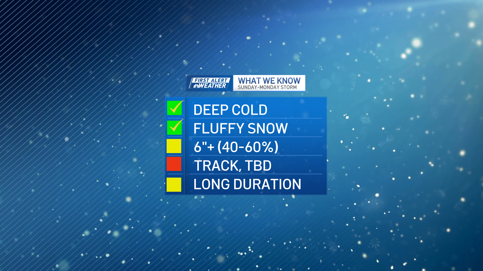
We still have to lock down the track and specific timing. We’re confident that lots of cold arctic air will be in place across the northeast for Saturday through Monday. This means the snow we get will be quite fluffy, adding up to quicker snowfall totals. Stay tuned for updates through the week.
Afternoon guidance:
The trend is that each model run has been inching this significant storm farther north. This means, the significant ice for the south is inching north and heaviest snow bands inching north as well over the Mid Atlantic. These northern shifts bring a bigger snow maker to New England.

The major weather models agree that significant snow (6-plus inches) is becoming more likely across New England from Sunday to Monday, with areas along the southern New England coast seeing higher numbers.
Of course, as the low forms on Thursday to Friday there could be wobbles that pull this storm further south, but right now there are indicators that New England could have a big snow maker on the way.