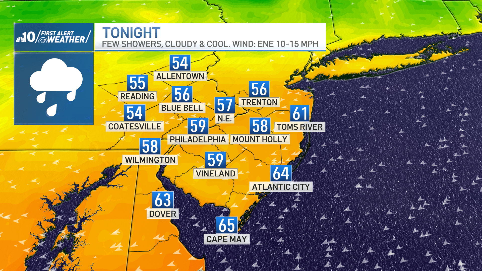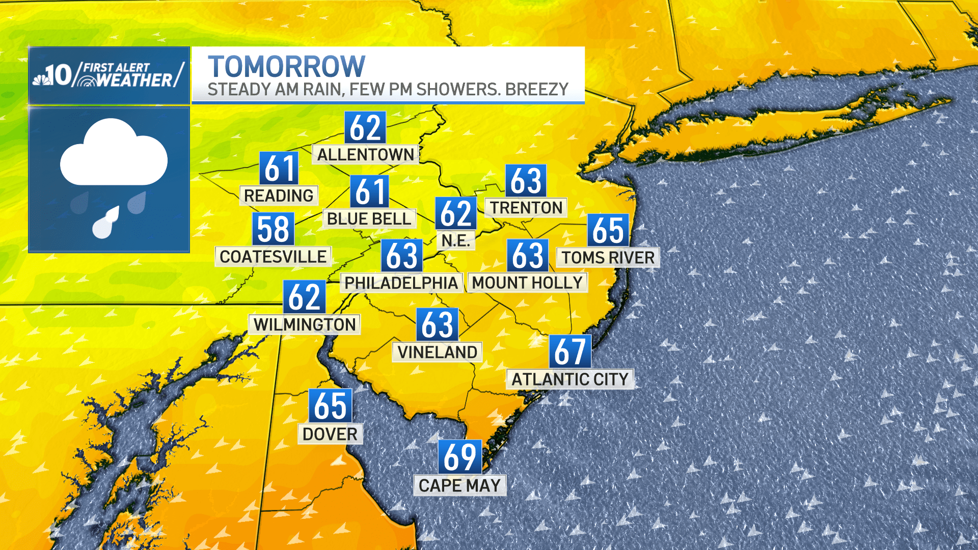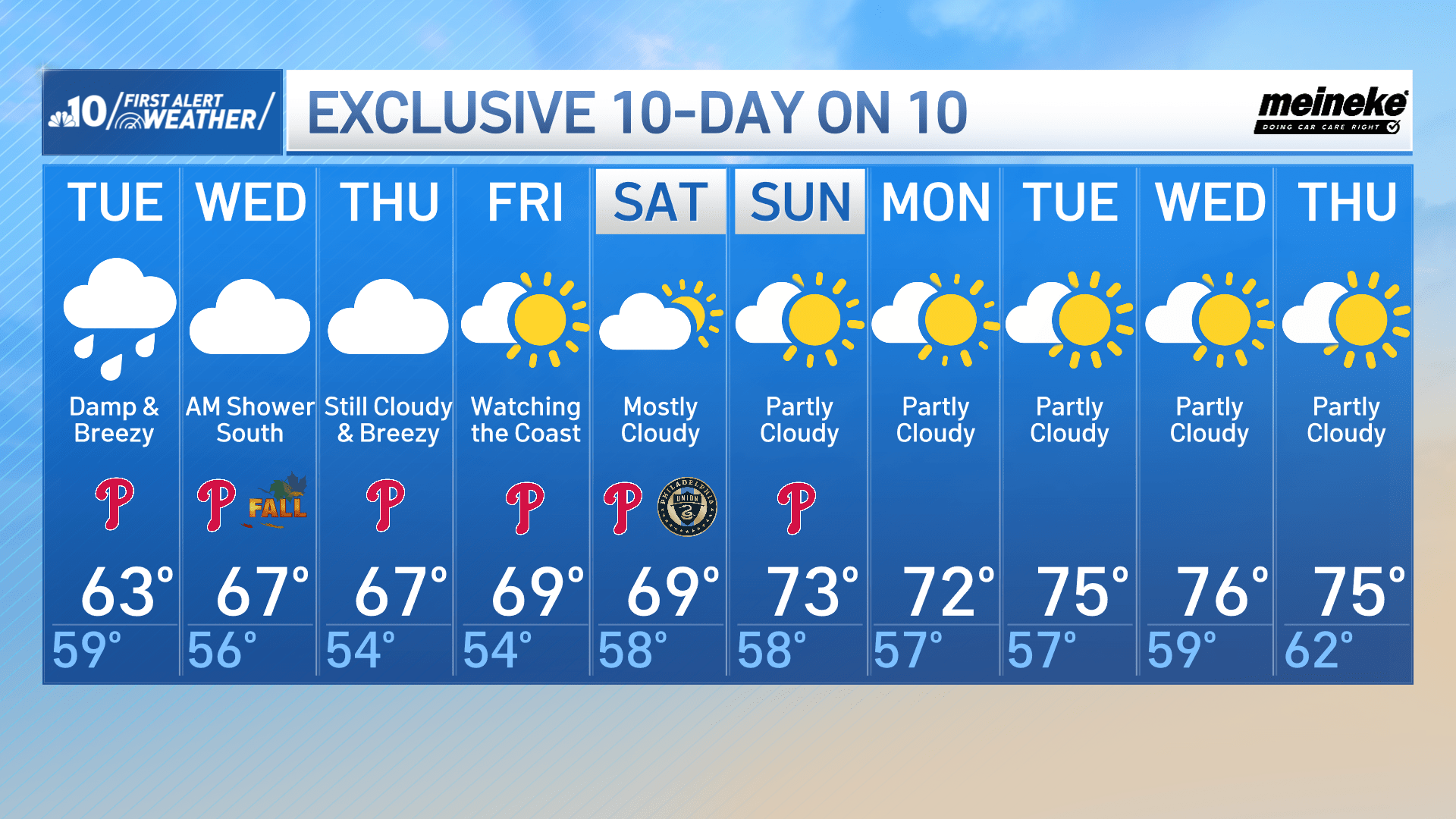
A weak front nearby will provide a few light scattered showers Monday evening and overnight in the Philadelphia region. Expect breezy conditions that will keep us cool with overnight lows in the 50s and 60s.
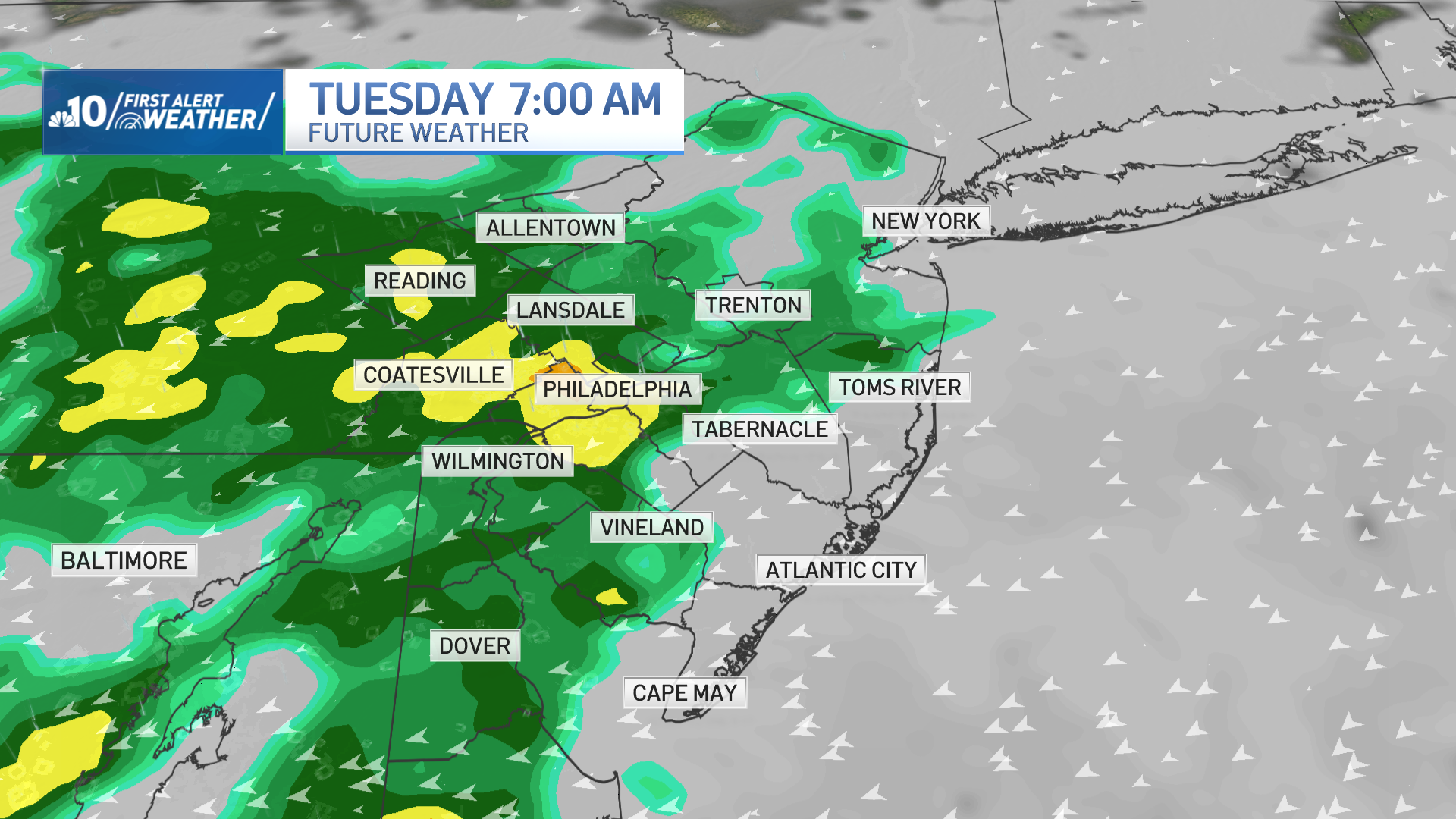
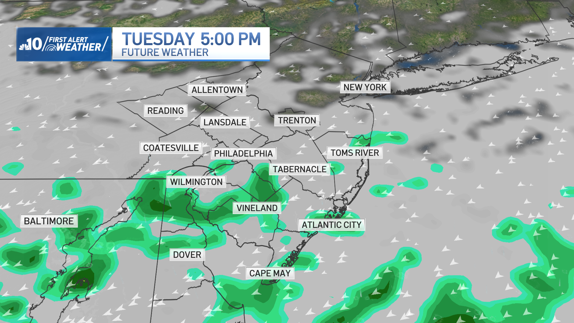
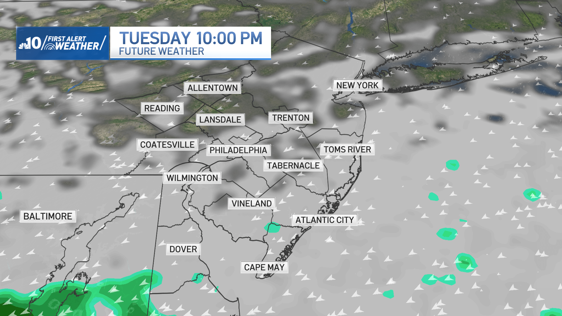
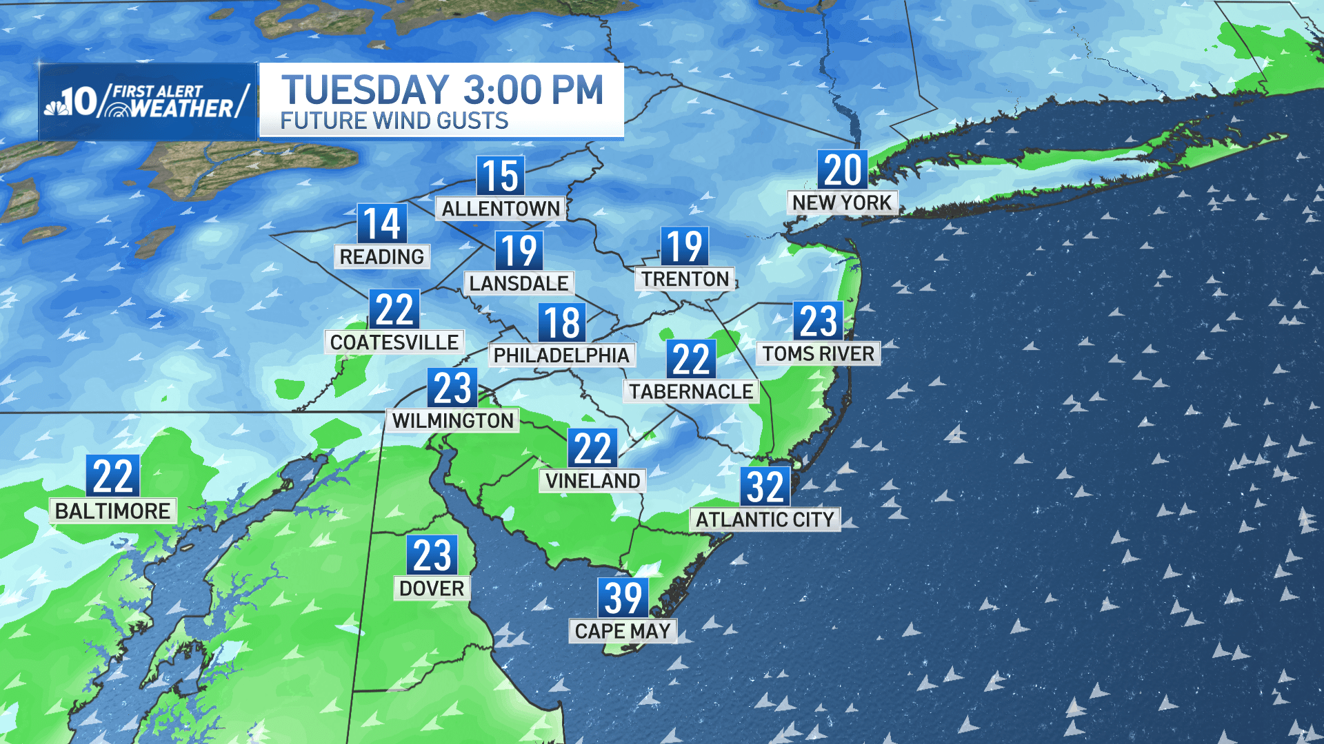
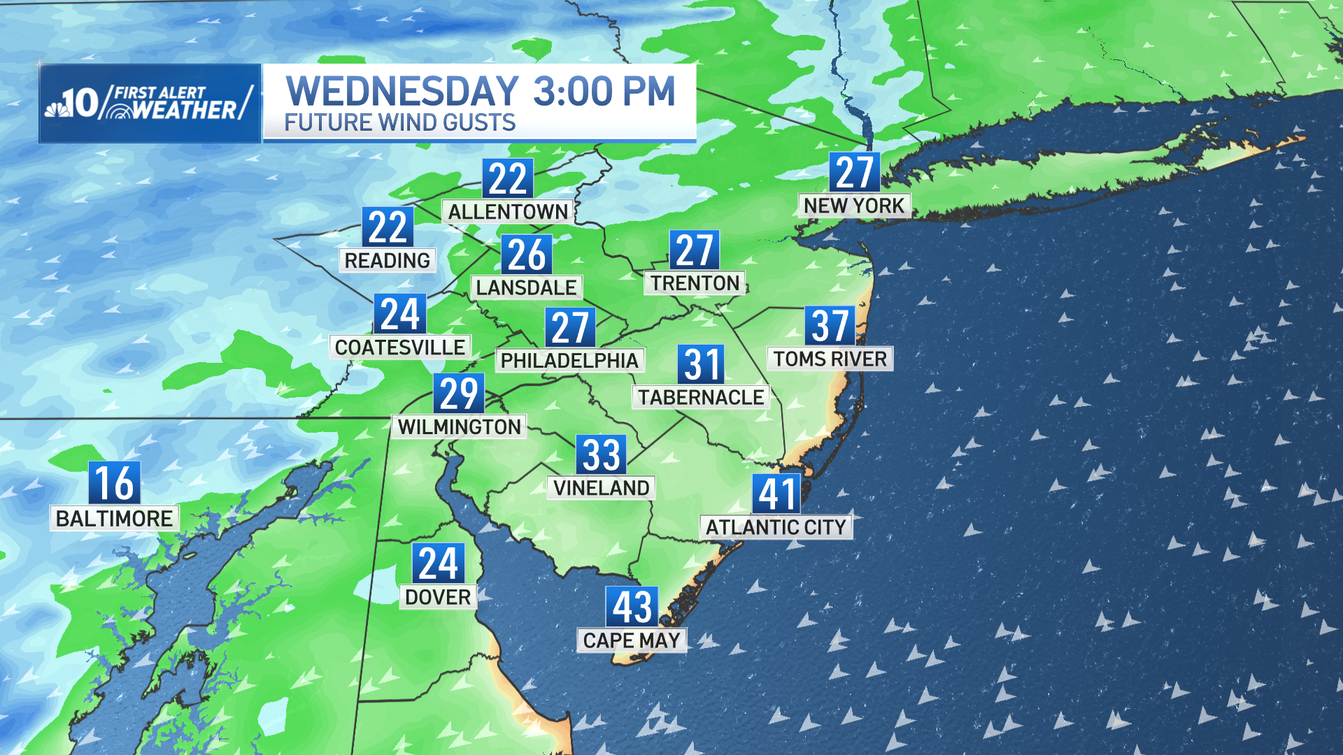
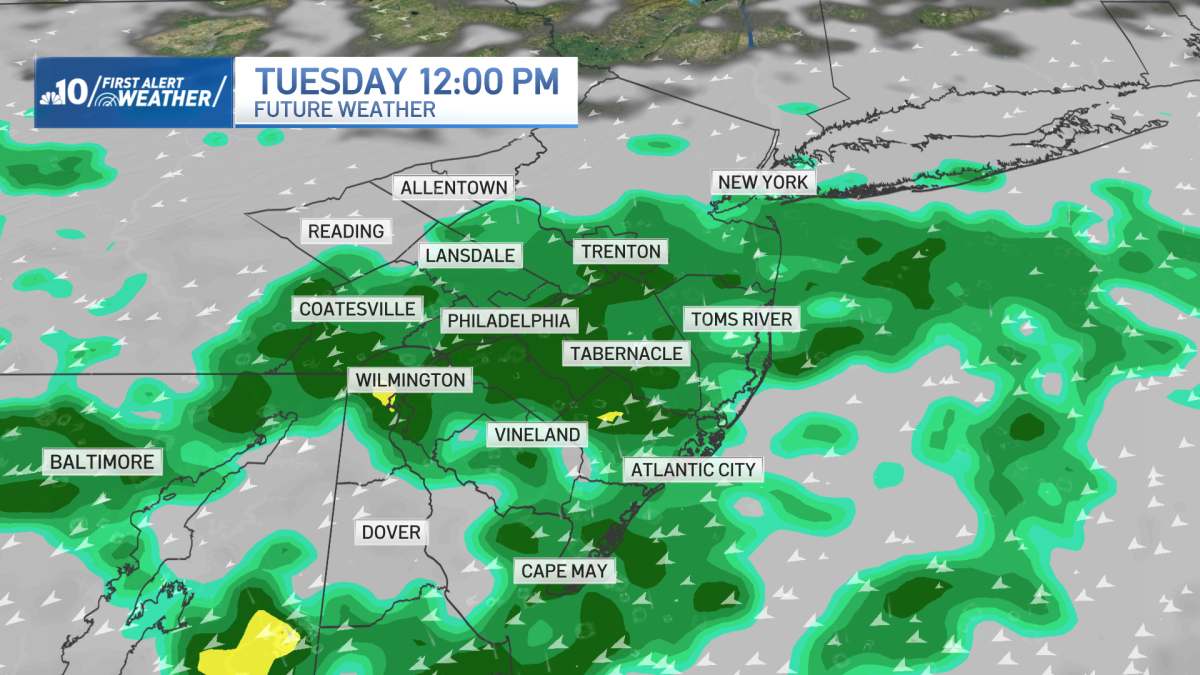
The same front slides farther north overnight to provide a steady rain Tuesday morning and early afternoon. Rain will taper off during the late afternoon and evening hours. Expect breezy east-northeasterly winds for Tuesday and even into Thursday. Temperatures will be about 10-15° below average over the next three days.
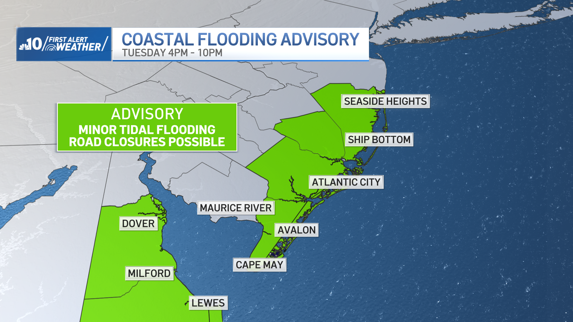
The stiff northeasterly breeze may bring coastal flooding along the Jersey Shore and coastal Delaware on Tuesday afternoon and night. Coastal flooding may continue to be an issue through at least Friday.
Later this week, a coastal low will develop in the Atlantic. The track of the low determines the impacts. As of now, we expect some rain and wind down the shore Friday into Saturday. Inland neighborhoods as of now appear dry, however, there is still plenty of uncertainty in the Friday-Saturday forecast.
More pleasant and seasonable conditions return next week.
Get the latest weather updates by downloading the NBC10 app and following the NBC10 First Alert Weather team.