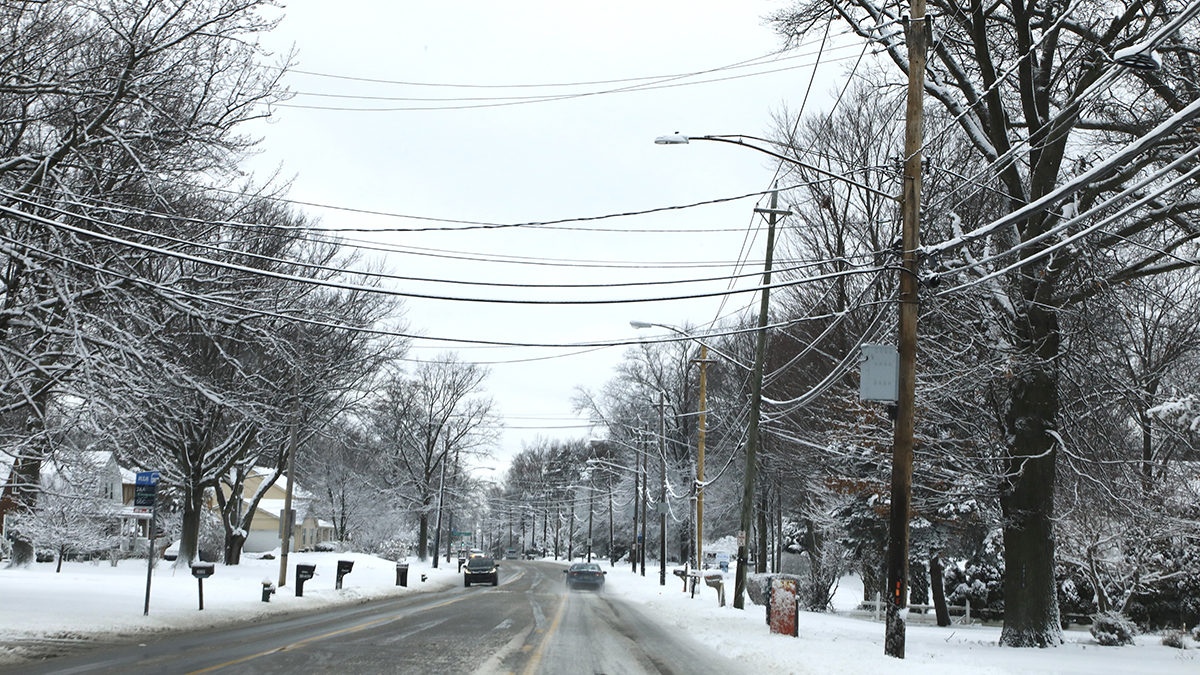
Bitter air is in route to New England today. While we still manage to make freezing in many spots today, it certainly won’t feel like it with an increasing wind and crumbling temperatures late day.
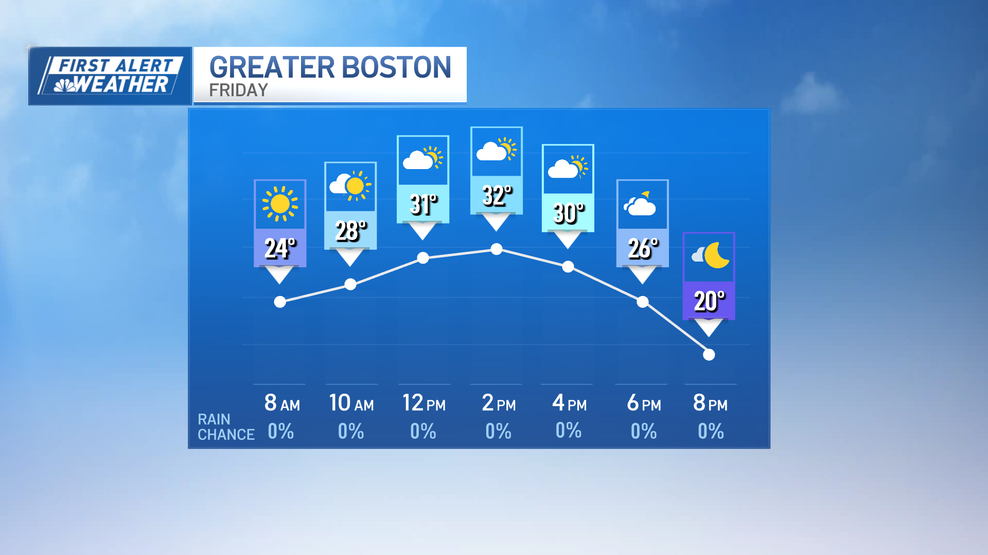
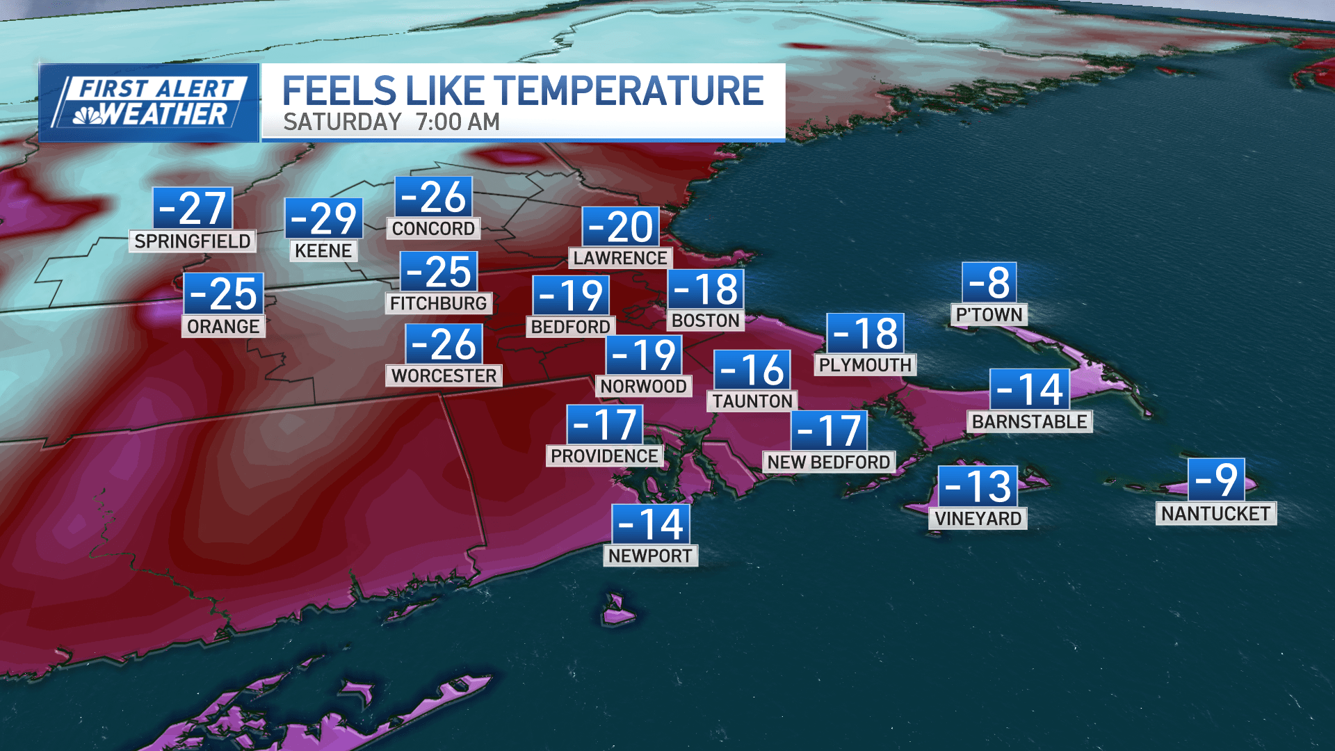
Frigid wind chills set in after dark, plummeting to 15 to 25 below by Saturday morning.
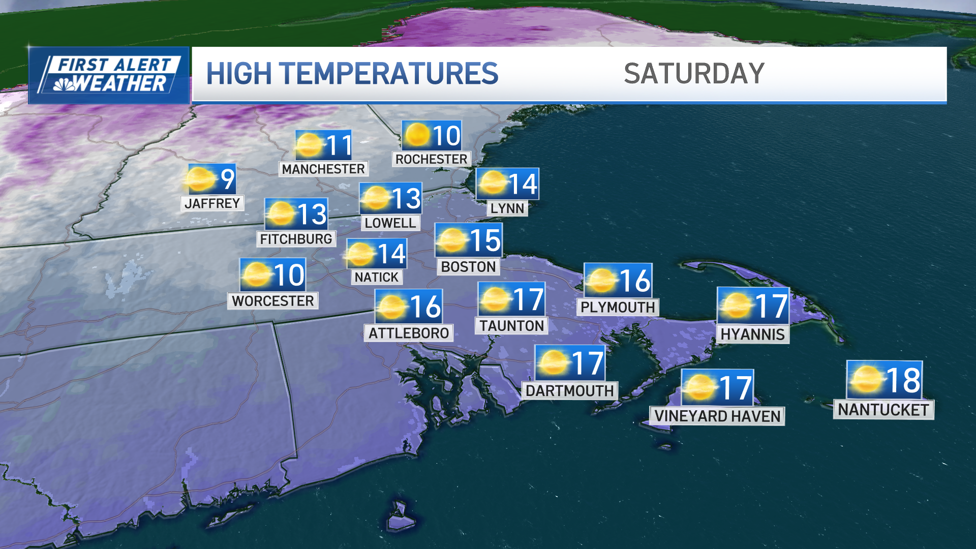
Thankfully, the winds back off on Saturday afternoon as our attention turns to the storm coming out of the Deep South.
Weather alerts
There are extreme cold warnings, winter storm watches and cold weather advisories across New England.
Click here for active weather alerts.
What we know about this weekend’s storm
By now you’ve seen the headlines and heard the warnings coming from across the country. From our perspective, this will be our biggest snowstorm in nearly four years in Boston.
And if you love wild weather, it won’t disappoint.
Snow timing and snowfall amounts
Snow should break out by mid-morning Sunday with intensity increasing later in the afternoon. Travel is not recommended after 4/5 p.m. through at least midnight as intense snow (with rates of 1-3” per hour and the possibility of thundersnow) moves through. It’s then that we gather about 70-80% of our snowfall from the storm.
While that’s ongoing, a milder flow of air will come in off the ocean and begin to lift our temperatures from the teens to the 20s – perhaps even near 30 at the water’s edge. Why does this matter?
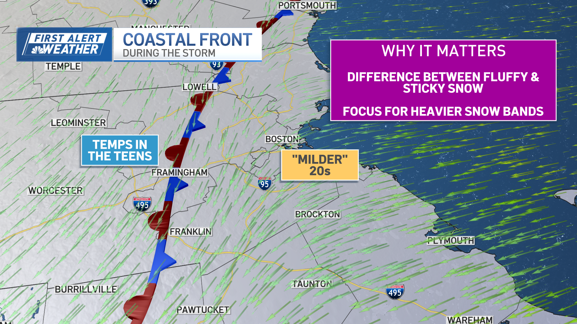
This boundary between arctic air and marginally cold air is called the coastal front, and it’s really the dividing line between the heaviest snowfall (16-20”) and the somewhat lower amounts (10-16”) you’re seeing near the coast.
This is also the difference between fluffy snow and more compacted snow.
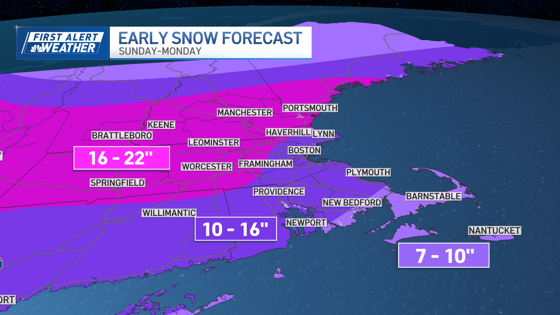
During this time, temps also rise on Cape, with some mixing after midnight. Here we’re thinking the snow will amount to 7-10 inches, with some rain eventually moving in.
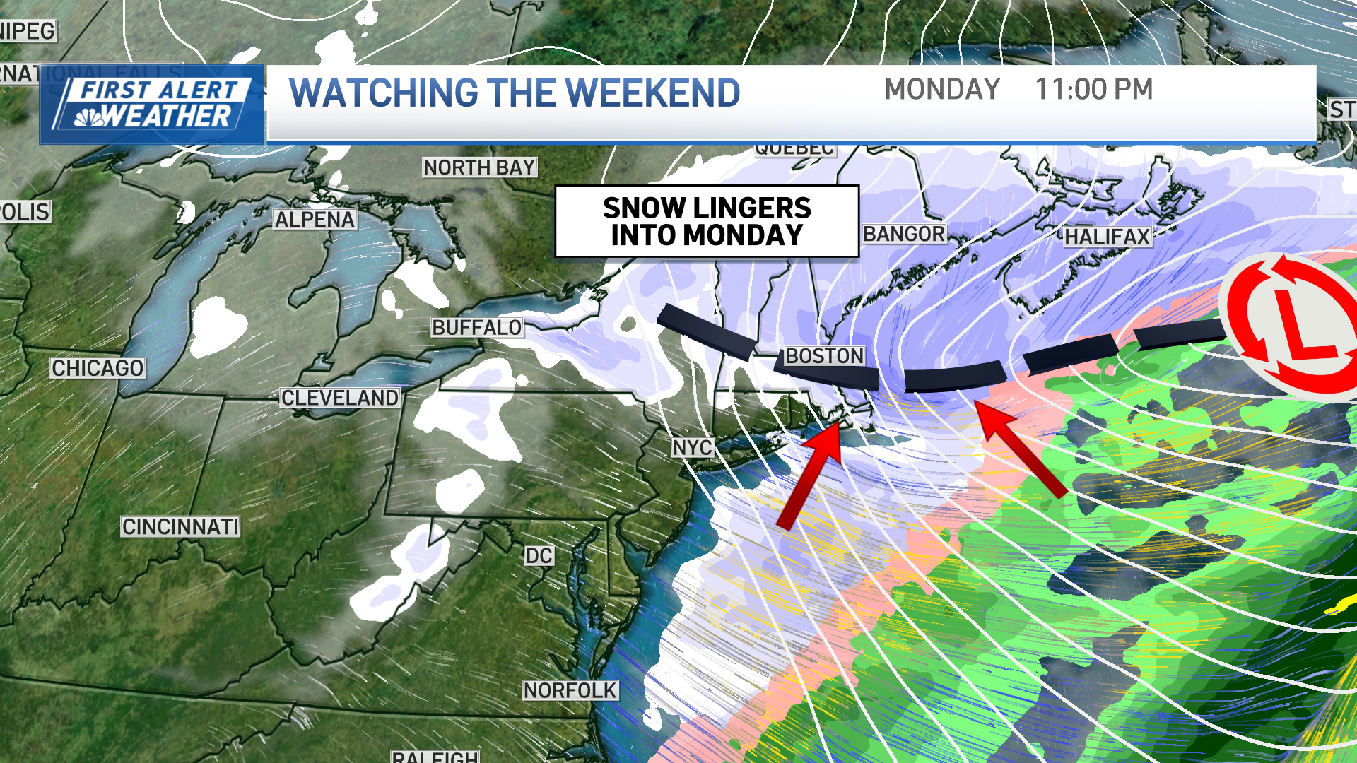
The storm’s intensity may drop late Sunday night, then return with lighter, steadier snow into Monday. Some guidance is suggesting that the snow will linger deep into Monday night, but we’re still uncertain about exactly where that may be. Perhaps it is only in Eastern Mass or perhaps it is farther north. That may be a game time decision – but also a critical one for additional snow accumulation.
Live radar
We’ll have updated maps, timelines, features, and stats through the day. Thank you for staying with us during the storm.
Be safe this weekend and GO PATS!!!!!!