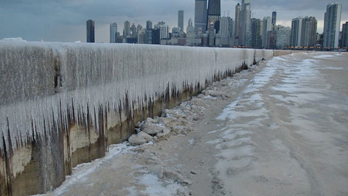
An extreme cold watch issued for the entire Chicago area this week has been upgraded by the National Weather Service to an extreme cold warning, with some schools already announcing closures ahead of what’s expected to be one of the coldest days the Chicago area has seen in years.
The dangerously cold weather for Illinois comes as millions of people from New Mexico to the Carolinas brace for a potentially catastrophic ice storm that could that could crush trees and knock out power for days, the Associated Press reported. That same system, which could bring snow to northern Illinois Saturday, is set to move to the east coast this weekend, where forecasters say the snowy conditions could make travel nearly impossible.
Ahead of the warning, Thursday was expected to be a quiet weather day with temperatures in the 20s, NBC 5 Storm Team Meteorologist Alicia Roman said. Early Thursday morning, temperatures across the area were in the teens but felt more like -2 degrees.
“This is going to feel fantastic compared to what’s coming,” Roman said.
The frigid temperatures and Arctic air on the way on the way are likely to break records, NBC 5 Storm Team Meteorologist Kevin Jeanes said. Such conditions could lead to frostbite in as little as 10 minutes.
Here’s a look at when and where the cold will be the worst, and what to know.
When and where will the extreme cold hit?
The sharp drop in temperatures and wind chills will come overnight, Roman said, starting at about midnight. At 3 a.m., the extreme cold warning for all of northeastern Illinois and part of southeastern Wisconsin will go into effect.
“This time tomorrow morning, we’re down to -10,” Roman said at 5 a.m. Thursday. Even colder air temperature readings were expected in counties to the north and west, between 6 a.m. to 11 a.m.
Wind chills will be even worse. Earlier in the week, forecasters said “feels-like” temperatures Friday morning could be as low as -30 or -35, but the predictions are even colder now.
“Perhaps down to -40,” Roman said, with the NWS saying the coldest wind chills will be expected across interior portions of northern Illinois.
Friday morning in Woodstock, the predicted “feels-like” temperature was -40 degrees. The temperature was expected to feel like -39 in DeKalb, -37 in DuPage, and -38 in Waukegan.
To the south and east, wind chills would be slightly better, in the -20s.
Through 11 a.m. Friday, the cold will be the most “critical” Roman said, as the temperatures and wind chills could lead to frostbite in as little as 10 or 15 minutes.
“Cover everything. All exposed skin,” Roman warned. “Because it will be very, very dangerous to be out there.”
Friday afternoon, things weren’t expected to get any better Roman said.
“-2 degrees is the high,” Roman advised.
Saturday, the high temperature was 11 degrees, and Sunday, the predicted high was 18, with snow chances both days.
How cold does it have to be to cancel school?
Such temperatures and wind chills have forced dozens of school closures in previous winters, and dozens of schools in the state, including Chicago Public Schools have already announced closures or shifts to e-learning Friday.
About 11:30 a.m., district officials said it make the decision to cancel classes Friday “after closely monitoring the forecast for the past 24 hours in collaboration with the City of Chicago’s Office of Emergency Management and Communications (OEMC) and other City agencies.”
You can find a full list of school closures and check to see the status of your school here. (NOTE: If you are accessing this link from our app, please go to your mobile browser).
This story uses functionality that may not work in our app. Click here to open the story in your web browser.