

What to Know
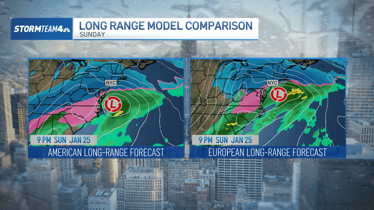
- At this time, we can’t confidently pinpoint exactly where the heaviest snow will fall, but that picture will become clearer Thursday into Friday.
- The Northeast will get hit hardest Sunday afternoon and evening, with residual light snow Monday. Expect travel to remain very difficult Monday morning. Anticipate school, business, and government office closures as well.
- The Northeast will get hit hardest Sunday afternoon and evening, with residual light snow Monday. Be prepared for travel to remain very difficult Monday morning and expect school, business, and government office closures on Monday, too.
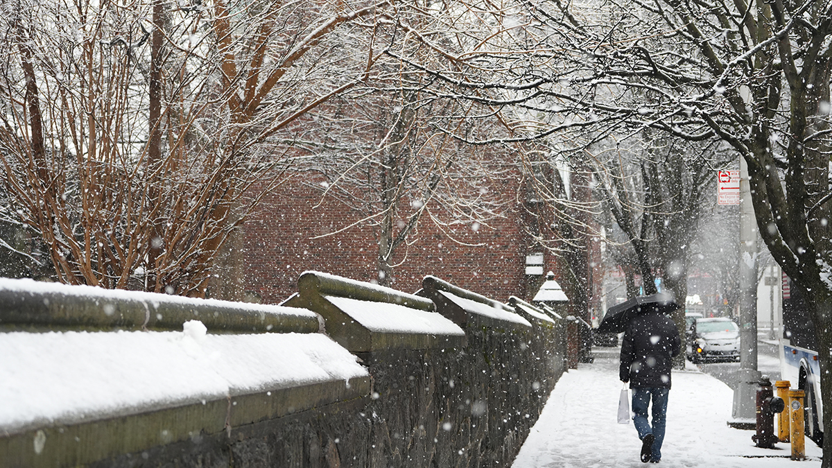
A major winter storm will pummel much of the United States this weekend, starting in Texas and the Great Plains and finishing along the East Coast. Here are five things the tri-state Area should know about the storm.
More coverage
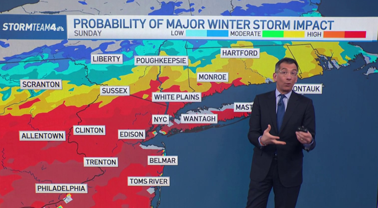
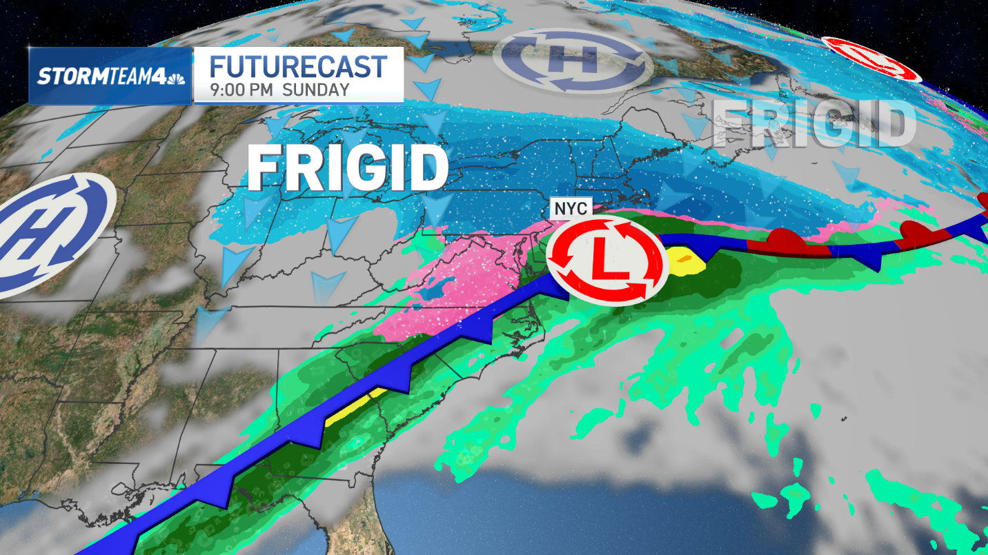
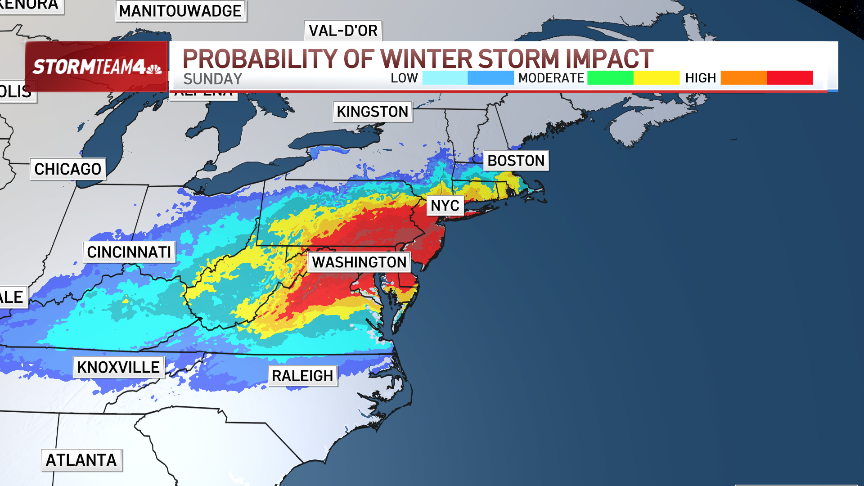
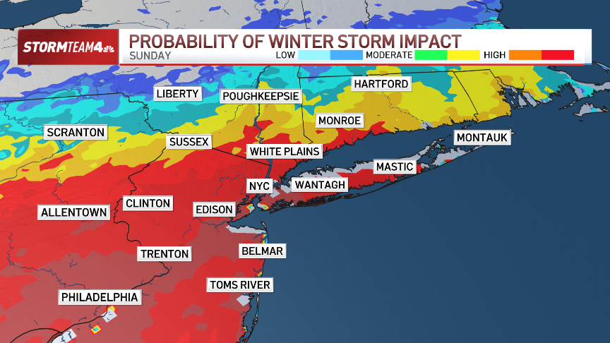
Sunday is the impact day for the East Coast.
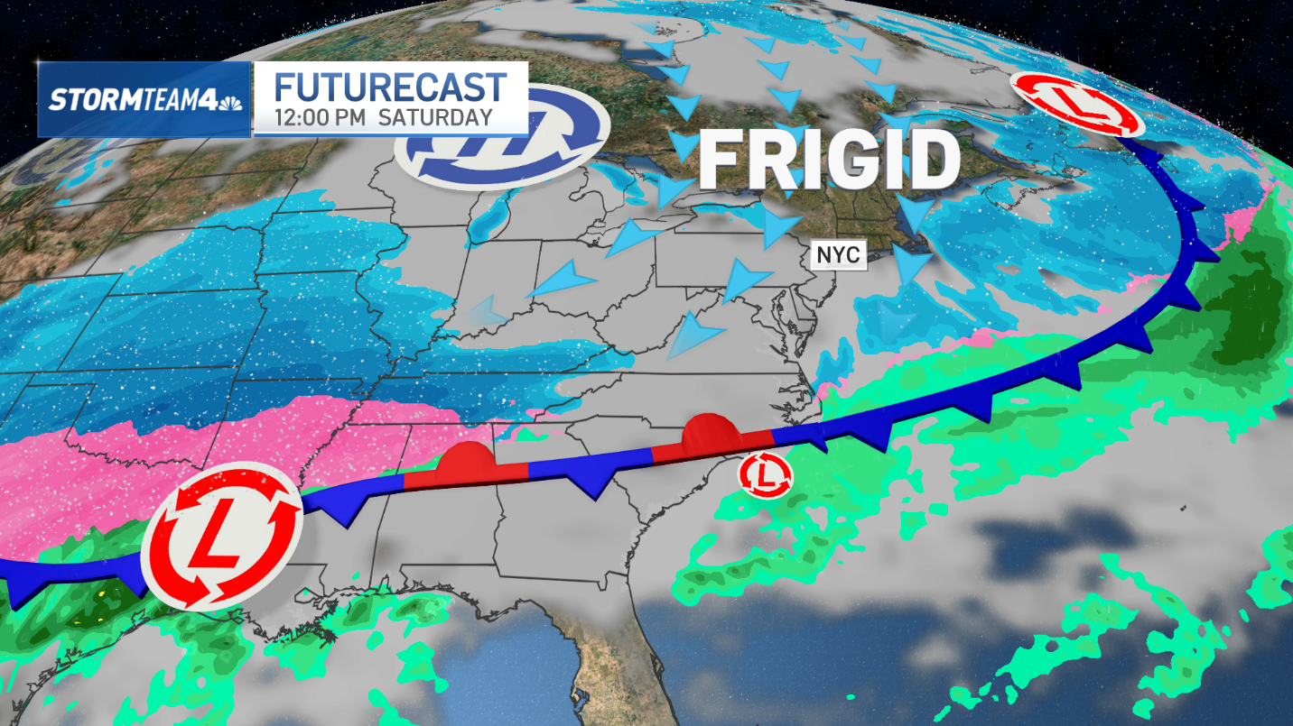
The storm will develop over Texas on Saturday, but the East Coast won’t feel a direct impact until Sunday. That’s when snow, sleet, freezing rain, and rain will impact everyone from New England to the Southeast.
In the Northeast, the biggest impact is likely to be from the New York City metro area to the south.
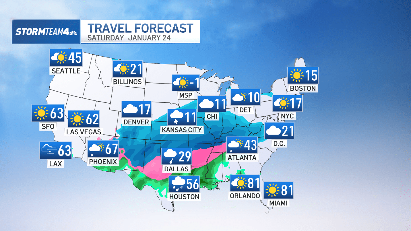
Travel trouble starts Saturday.
Weather on the East Coast will be quiet Saturday, but air travel will likely be a mess.
Snow and ice could grind airports to a halt in the middle of the country. Hubs like Dallas/Fort Worth, St. Louis, Memphis, Nashville, Cincinnati, and possibly Atlanta will be impacted, and the ripple effect will cause delays and cancellations across the country.
Snow totals will be impressive for some.
Once the storm makes it to the East Coast on Sunday, it will be a prolific snow-maker in certain regions – very possibly including the tri-state.
Snow totals will depend on the track of the storm and the precipitation type. Some areas will see all snow. That’s where over a foot of snow will be easy to get. Other places may see a mix of snow, sleet and freezing rain, which will significantly limit snow totals.
At this time, we can’t confidently pinpoint exactly where the heaviest snow will fall, but that picture will become clearer Thursday into Friday.
Ice could make travel treacherous
South of the heavy snow area, we expect a band of sleet and freezing rain to set up, which will make travel a nightmare Sunday night into Monday morning. As with the snow, it’s too early to call exactly where that band of ice will develop, but at this point, the I-95 corridor through South Jersey, the Delmarva Peninsula Washington D.C., Virginia and North Carolina are places to avoid Sunday and Monday.
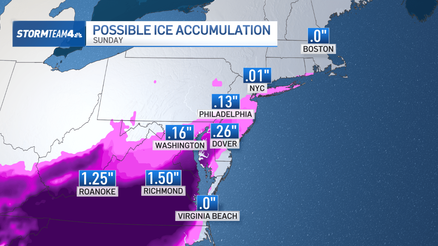
Further down the coast, we expect all rain due to warmer temperatures.
Expect Monday to be a mess
The Northeast will get hit hardest Sunday afternoon and evening, with residual light snow Monday. Be prepared for travel to remain very difficult Monday morning and expect school, business, and government office closures on Monday, too.


